
From frozen poles to massive canyons: New images of Mars reveal the planet's surface in stunning detail
- Mars was once covered with oceans, ice sheets and erupting volcanoes that towered over the planet
- The surface of the planet is filled with fascinating bumps and scratches revealing its geological history
- The Mars Reconnaissance Orbiter has been orbiting and capturing pictures of the surface since 2006
- Now a team working on the instrument has released more than 600 new images taken by the camera
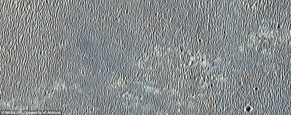
The surface of the red planet may be a desolate land with little geological activity now, but it is filled with fascinating bumps and scratches from frozen poles to deep basins, all hinting at a geologically active past.
Now a team at Nasa has released more than 600 images of Mars, showing a range of gullies, dunes, craters, geological layering and other features.
Each feature teaches us something new about the history of our mysterious neighbour, which used to be covered with oceans, ice sheets and erupting volcanoes.

The Mars Reconnaissance Orbiter has been circling the red planet, capturing pictures using its High Resolution Imaging Science Experiment (HiRISE) camera, since 2006. Now the team behind the orbiter has published hundreds of new images. Hyblaeus Dorsa, one of the ridges on the planet, is shown
The Mars Reconnaissance Orbiter has been circling the red planet, capturing pictures using its High Resolution Imaging Science Experiment (HiRISE) camera, since 2006.
The team behind the orbiter, led by Nasa's Jet Propulsion Lab in Passadena and the University of Arizona, has now published hundreds of new images taken by the instrument.
Among the images are hundreds showing one of its most fascinating features: craters.


There are hundreds of thousands of impact craters on Mars, caused by encounters with other objects such as asteroids, but only some of them have names.
Other craters were formed in different ways, through volcanic activity, for example.
Some of these craters have provided clues to the most fascinating history of the Martian surface.

Other craters were formed in different ways, through volcanic activity, for example. Some of these craters have provided clues to the most fascinating history of the Martian surface. Concave fagged features in the Tempe Fossae region, a group of troughs in the Arcadia quadrangle of Mars, shown

Among the images are hundreds showing one of its most fascinating features: craters. This picture shows a crater in the Chryse Planitia region, a relatively smooth, circular plain. Some think the plain is an ancient impact basin, in the north equatorial region of Mars

The surface of Mars is a well worn place in the solar system, heavily pounded by countless meteor impacts. And some of these craters are hundreds of millions of years old. So it’s unusual for there to be a completely fresh impact on the surface. A recent impact site is pictured

Mesa-Forming layered materials pictured. A mesa is an elevated area of land with a flat top and sides that are usually steep cliffs
Mars is now a frozen desert, but geological studies of rocks by previous missions to the surface have suggested the planet used to be warmer and wetter.
The polar caps on the planet spend much of their time, during the pole's winter, in continuous darkness.
When the poles are again exposed to sunlight, the frozen carbon dioxide sublimes into gas, creating enormous winds that sweep off the poles as fast as 250 mph (400 km/h).
The caps at both poles are mainly made of water ice.
Frozen carbon dioxide accumulates as a thin layer about one metre thick on the north cap in the northern winter only, while the south cap has a permanent dry ice cover about 26 feet (8 metres) thick.
Both polar caps have spiral-shaped troughs (pictured), which analysis of ice penetrating radar has shown are a result of spiralling winds.

The polar caps on the planet spend much of their time, during the pole's winter, in continuous darkness. When the poles are again exposed to sunlight, the frozen carbon dioxide sublimes into gas, creating enormous winds that sweep off the poles as fast as 250 mph (400 km/h). The south polar residual cap is pictured

Cerberus Fossae (pictured) is a long fracture system in the southeastern part of Elysium. The system has acted as a conduit for the release of both lava and water onto the surface of the planet. Mars is now a frozen desert, but geological studies of rocks by previous missions to the surface have suggested the planet used to be warmer and wetter

The total volume of ice in the south polar cap, including nearby layered deposits, is around 380,000 cubic miles (1.6 million cubic km). Both the north and south polar caps have spiral-shaped troughs (south pictured), which analysis of ice penetrating radar has shown are a result of spiralling winds
At one point, Mars was covered with oceans, ice sheets and erupting volcanoes that created the mountains that tower over the planet.
Some of these remain, like Olympus Mons - the largest-known volcano in the solar system, measuring 15 miles (24 km) high.
Olympus Mons, the solar system's biggest volcano, three times higher than Mount Everest, is thought to have had its last major eruption as recently as 25 million years ago.

At one point, Mars was covered with oceans, ice sheets and erupting volcanoes that created the mountains that tower over the planet. Some of these remain, like Olympus Mons - the largest-known volcano in the solar system, measuring 15 miles (24 km) high. Olympus Mons (pictured) is the solar system's biggest volcano, three times higher than Mount Everest

Groundwater moving beneath a massive tectonic rift zone helped carve some of Mars' deepest basins. A study published earlier this year claimed these basins may have been habitable, suggesting that life once existed on the red planet. A valley in the Northern Hellas Planitia, pictured
Billions of years ago Mars might have been home to even larger volcanoes.
Evidence collected by Nasa's Curiosity rover earlier this year showed these ancient volcanoes might have been a lot more powerful than we had thought.
Curiosity's instruments found a substance called tridymite - a kind of crystal that only forms on Earth as a result of extremely hot, silcic volcanoes.
The tridymite was found in the Gale crater, a crater that spans 96 miles (154km) in diameter and holds a mountain rising from the crater floor.
Silicic volcanism is a highly explosive form of volcanic activity, which happens as tectonics plates move from the Earth’s outer shell into the Earth’s mantle and force water into the molten depths.
The plates melt into magma, which is ejected out into the surface in a powerful eruption.
There has been no evidence found for plate tectonics on Mars so far, so how the silcic volcanism occurred is a mystery.

Coprates Chasma, is a major trough in the Valles Marineris canyon system, pictured. Evidence collected by Nasa's Curiosity rover earlier this year showed these ancient volcanoes might have been a lot more powerful than we had thought

Isidis Planitia, pictured, is a plain inside a giant impact basin on Mars. Groundwater moving beneath a massive tectonic rift zone helped carve some of Mars' deepest basins. A study published earlier this year claimed these basins may have been habitable, suggesting that life once existed on the red planet
Groundwater moving beneath a massive tectonic rift zone helped carve some of Mars' deepest basins.
A study published earlier this year claimed these basins may have been habitable, suggesting that life once existed on the red planet.
The discovery could help future exploration missions decide where to look for evidence of Martian life.
'The temperature ranges, presence of liquid water, and nutrient availability, which characterize known habitable environments on Earth, have higher chances of forming on Mars in areas of long-lived water and volcanic processes,' said lead author Alexis Palmero Rodriguez.
Sand dunes are among the most widespread features on Mars, serving as unique indicators of the interaction between the atmosphere and surface.
On a planetary body, dunes accumulate where a supply of sand-sized grains exists or may be abraded, is carried downwind by winds, and is subsequently deposited where these winds weaken below the threshold for sand transport.
Dunes can be preserved in rock over time. This means the deposits can reveal insights into the evolution of Mars' atmosphere from a more hospitable realm to the harsh, dry climate there today.
As a result, the study of dune processes contributes to both atmospheric and sedimentary science.

It might look more like bacteria growin in a petri dish, but this picture actually shows frosty dunes on Mars' surface. Sand dunes (pictured) are among the most widespread features on Mars. Dunes form where a supply of sand-sized grains exists or may be abraded then carried downwind by winds

Dunes in the Russell Crater, pictured. Dunes can be preserved in rock over time. This means the deposits can reveal insights into the evolution of Mars' atmosphere from a more hospitable realm to the harsh, dry climate there today. As a result, the study of dune processes contributes to both atmospheric and sedimentary science

On a planetary body, dunes accumulate where a supply of sand-sized grains exists or may be abraded, is carried downwind by winds, and is subsequently deposited where these winds weaken below the threshold for sand transport. Dunes can be preserved in rock over time
The surface of Mars is also covered with narrow, deep channels known as gullies.
Martian gullies carved into hill slopes and the walls of impact craters were discovered several years ago.
Exactly how these gullies formed is not fully understood - previous research had suggested the structures were a result of flowing liquid water, because water makes similar structures on Earth.
Polar ice caps were discovered on the planet four decades ago, and erosion patterns on the surface strongly suggest rivers and oceans may have existed there in its early years.
With low gravity and a thin atmosphere, it was thought that this water largely evaporated out into space, instead of falling back down, as it would have done on Earth.
But new research shows water is not behind the Martian gullies, instead suggesting they could be created by carbon dioxide freezing and thawing.
INDIAN SPACE PROBE SNAPS NEW IMAGES OF THE RED PLANET

India's space agency has released a new series of beautiful images, beamed back from its Mars orbiter, revealing our closest planetary neighbour in all its glory
The spotlight surrounding research on Mars is often on the US, European and Russian space agencies.
But while it may be overlooked, the Indian Space Research Organisation (ISRO) remains one of only three national space programmes to have reached the red planet to date.
To celebrate its achievements, the space agency has released a new series of beautiful images using data beamed back from its Mars orbiter, revealing our closest planetary neighbour in all its glory.
India's Mars Orbiter Mission, called 'Mangalyaan', reached the red planet in September 2014.
Since then it has been taking measurements, collecting data and capturing images from orbit.
Last month, ISRO released its first full year’s data from the orbiter – covering the period up to September 2015 – with its incredible images beamed back in a stream of pixels.
The ExoMars Landing Site, taken on 14 August. The ExoMars Trace Gas Orbiter (TGO) launched from Baikonur Cosmodrome in Kazakhstan aboard a heavy lift Proton rocket on 14 March to begin a seven-month, 300 million-mile (483 million km) journey to the red planet.


A spacecraft designed to search the atmosphere of Mars for clues of life on the surface of the red planet successfully blasted off in March this year.
The ExoMars Trace Gas Orbiter (TGO) launched from Baikonur Cosmodrome in Kazakhstan aboard a heavy lift Proton rocket on 14 March to begin a seven-month, 300 million-mile (483 million km) journey to the red planet.
It is due to analyse Mars' atmosphere to search for low levels of gases such as methane that may betray the presence of alien life on the planet's surface.
ExoMars 2016 is the first phase of an historic €1.2 billion (£924 million) joint European-Russian mission to search for biochemical 'fingerprints' of past or present life high above Mars and on its surface.
Scientists believe the probe has the potential to find 'very strong evidence' of alien life when it arrives at Mars on 19 October.
Scientists hope to land the ExoMars rover in Oxia Palus, a plain located on the north east of Mars.
However, any new data won't be shared until the end of next year at the earliest, because the probe has to spend a year decelerating so it can graze the atmosphere at a slow enough speed.
In 2018, a robotic probe built by Lockheed Martin for Nasa, the Mars InSight mission, will set off for red planet.
It forms part of wider efforts to glean information about the planet's rich geological past.
Most watched News videos
-
 CCTV captures final tragic moments of Mirna Salihin's life
 -
 Mother shaves daughters hair after she 'bullies cancer girl'
 -
 GRAPHIC CONTENT: 'Ghost' rises from body after fatal crash
 -
 Bulls head butt each other then die instantly from brutal blow
 -
 Shocking moment girl gets viciously beaten after starting fight
 -
 Mother releases devastating footage of son's final moments
 -
 Lorry smashes into car leaving driver with severe injuries
 -
 Is this the creepy moment the corpse of a girl OPENS her eyes?
 -
 'Big fat gypsy wedding' in Romania goes on for FOUR days
 -
 Groom ALREADY tired of marriage life just after 15 minutes
 -
 'Pascal's a G!' Kim Kardashian speaks well of her bodyguard
 -
 GoPro captures the moment a croc swims amongst swimmers
-
 Donald's Great Escape: Trump keeps his campaign alive with...
-
 The Donald hoists his mini-me on stage as his crowd roars –...
-
 Billy Bush 'BRAGGED to his NBC co-workers about lewd Trump...
-
 From a smiling pose to staring eerily into the distance:...
-
 Meth mother 'sat back and watched her boyfriend and his...
-
 This is what happens when you try and go in the 'secret back...
-
 Now Wikileaks reveals how Bill Clinton's closest adviser...
-
 Sickening moment teenage girl trying to take a selfie is...
-
 Trump DARES the Clintons and the press to unveil more...
-
 EXCLUSIVE: Money trouble? Kanye West took out a massive...
-
 Wheelchair-bound woman is gang-raped by six migrants at...
-
 PIERS MORGAN: The night Bill Clinton and his loose zipper...


 Cute moment elderly woman gets husband back when he dances with younger woman to rap song on crowded train
looking at these images makes me realise how beauti...
by Benny Hill 5