
A Scientific Report
by
Clayton Brough, Climatologist, KTVX
Dan Brown, HMT/Webmaster, NWS
David James, Geographer, BYU
Dan Pope, Meteorologist, KSL
Steve Summy, OPL, NWS
Salt Lake City Tornado
- August 11, 1999
|

Salt Lake City Tornado, August
11, 1999
|

Orange fireball is a power
sub-station exploding.
(August 11, 1999, Salt Lake City)
|

Looking to the east on North
Temple Street...just west of Redwood Road
On August 11, 1999, an F2 tornado touched down in the
metropolitan area of Salt Lake City. The tornado lasted ten minutes
and killed one person, injured more than 80 people, and caused more
than $170 million in damages. It was the most destructive tornado in
Utah's history, and awakened the entire state's population to the fact
that the Beehive State does experience tornadoes.
Generally speaking, atmospheric conditions are rarely favorable for
the development of tornadoes in Utah due to its dry climate and mountainous
terrain. On fact, Utah ranks as having one of the lowest incidences
of tornadoes in the nation, averaging only about two tornadoes per year,
with only one F2 or stronger tornado once every seven years. From January
1950 to August 11, 2005, 121 tornadoes and 22 waterspouts have been
reported in the state.
In the central U.S., tornadoes are commonly one-fourth of a mile wide
and often cause considerable destruction and death. However, Utah tornadoes
are usually smaller in size--often no more than 60 feet wide (at the
base)--with a path length usually less than a mile and a life span of
only a few seconds to a few minutes. They normally follow a path from
a southwesterly to a northeasterly direction and usually precede the
passage of a cold front.
About 73% of all Utah tornadoes have occurred in May, June, July and
August, when severe thunderstorms occasionally frequent Utah. Also,
69% of all Utah tornadoes have occurred between the hours of Noon and
5:00 PM (MST), while 55% of all waterspouts have happened in the morning
hours.
There have probably been more tornadoes and waterspouts in Utah than
the following statistics and accounts indicate. In fact, in recent years
an increasing number of these storms have been reported--probably due
to Utah's increasing population and greater public awareness about twisters.
However, sometimes people have mistaken whirlwinds (or dustdevils),
microburst winds and other natural phenomena as tornadoes. Thus, every
report of possible tornadic activity that appears in this publication
has been carefully reviewed and analyzed to assure the greatest degree
of accuracy possible.
Synoptic Analysis:
On the morning of August 11, 1999, an upper level trough of colder air
moved into northern Utah from Nevada. In advance, warm breezy southerly
winds blew over the Salt Lake Valley. By Noon, there was evidence that
either an old frontal boundary existed or a convergence zone had developed
across the Salt Lake Valley due to breezes from the Great Salt Lake
meeting up with the southerly winds that prevailed through the majority
of the valley. The Salt Lake morning sounding indicated some vertical
shearing of the winds (differences in wind speeds) along with the jet-stream
over northern Utah. As this happened, thunderstorms began to form over
the Oquirrhs in the Herriman area and over the south end of the Great
Salt Lake/north end of the Oquirrhs in the Magna area. By 12:35 PM,
there was a thunderstorm over the north portion of the Salt Lake Valley–with
clouds tops extending up to 41,000 feet high–that rapidly intensified
and generated a rare F2 tornado.
Event Analysis: On August 11, 1999,
an F2 tornado (having winds of 113 to 157 mph) did considerable damage
as it tracked northeastward across the metropolitan area of Salt Lake
City. One person was killed and over 80 people were injured--with 15-20
serious injuries reported. The tornado produced F0 wind damage at 12:41
PM from about 400-500 South/Navajo (1340 West) to about 300 South/Goshen
(1040 West). The tornado reached F2 strength by 12:45 PM.
From 300 South/1040 West the tornado tracked northeast producing widespread
damage at the Delta Center–including the destruction of one of
the large outdoor tents set up for the Outdoor Retailers Convention.
The collapse of the large tent facility killed one man: Allen Crandy.
The tornado also damaged the Wyndham Hotel, which had to be closed for
several days until the damage could be repaired.
From the Wyndham Hotel, the tornado continued its northeast track, knocking
down scaffolding and shearing off a crane at the site of the LDS Church's
new Assembly Hall that was under construction. Next, it went up Capitol
Hill and along the southeast side of the Capitol, through Memory Grove,
and up along the northwest portion of the Avenues–just barely
missing the LDS Hospital. It then lifted off the ground at about Edge
Hill/Terrace Hill (20th Avenue and P Street). Along its path through
the Avenues, houses experienced from minor to major damage, with hundreds
of trees either uprooted or damaged. Throughout much of the tornado's
destructive path, vehicles were tossed around and many were damaged
or totaled by falling trees.
This F2 tornado was on the ground from 12:45 PM to 12:55 PM (10 minutes).
It traveled a distance of about 3-3/4 miles, and had a width of about
100 to 200 yards. From F0 to F2 intensity, the tornado traveled 4-1/4
miles, lasted 14 minutes, and traversed an elevation difference of 1,095
feet (from 4,225 feet to 5,320 feet).
Here are some other facts and figures about this
destructive tornado:
1 death. 80 injuries.
300 buildings or houses were damaged, with 34 homes left uninhabitable.
500 trees were destroyed, and another 300 trees were significantly damaged.
A portion of Memory Grove was completely destroyed.
A major power outage occurred in the downtown area of Salt Lake City,
Capitol area and portions
of the Avenues.
Total damage estimates: about $170 million dollars.

Tornado Statistics for Utah: January 1950 to Present
Size of Tornadoes: Funnel diameter is usually
10 to 20 yards wide.
Largest reported funnel diameters: 440 yards wide
on December 2, 1970; 800 feet wide on Septermber 8,
2002; 200 yards wide on May 30, 1986 and August 30,
1992; 100 to 200 yards wide on August 11, 1999; and
100 yards wide on May 6, 1981 and July 25, 1991.
Duration of Tornadoes: Usually only a few seconds
to a few minutes.
Greatest amount of time on the ground: 15 minutes
on July 9, 1962, July 25, 1991,
August 30, 1992, July 24, 1998 and September 8, 2002.
Color of Tornadoes: Usual color- gray or brown.
Other colors: black on July 9, 1962; red on July 24,
1981; and white on December 2,
1970 and March 29, 1982. Tornado Statistics for Utah:
January 1950 to the Present
| Number of Tornadoes by Year: |
Number of Tornadoes by Month |
| 1950 |
0 |
1970 |
5 |
1990 |
4 |
| 1951 |
0 |
1971 |
1 |
1991 |
5 |
| 1952 |
0 |
1972 |
0 |
1992 |
4 |
| 1953 |
2 |
1973 |
0 |
1993 |
6 |
| 1954 |
1 |
1974 |
0 |
1994 |
0 |
| 1955 |
3 |
1975 |
0 |
1995 |
2 |
| 1956 |
0 |
1976 |
0 |
1996 |
3 |
| 1957 |
1 |
1977 |
0 |
1997 |
1 |
| 1958 |
0 |
1978 |
1 |
1998 |
8 |
| 1959 |
0 |
1979 |
0 |
1999 |
5 |
| 1960 |
0 |
1980 |
0 |
2000 |
7 |
| 1961 |
1 |
1981 |
2 |
2001 |
4 |
| 1962 |
1 |
1982 |
3 |
2002 |
4 |
| 1963 |
1 |
1983 |
0 |
2003 |
4 |
| 1964 |
1 |
1984 |
6 |
2004 |
2 |
| 1965 |
5 |
1985 |
0 |
2005 |
4 |
| 1966 |
2 |
1986 |
3 |
2006 |
2 |
| 1967 |
2 |
1987 |
3 |
2007 |
1 |
| 1968 |
4 |
1988 |
1 |
2008 |
0 |
| 1969 |
3 |
1989 |
6 |
2009 |
3 |
| . |
. |
. |
. |
|
Total 127 |
|
| January |
1 |
July |
15 |
| February |
1 |
August |
25 |
| March |
4 |
September |
21 |
| April |
7 |
October |
0 |
| May |
31 |
November |
2 |
| June |
18 |
December |
2 |
| . |
. |
|
Total
127
|
|
Number of Tornadoes
by Hour (MST) |
Number of Tornadoes
by County |
| 1:00 AM |
1 |
1:00 PM |
13 |
| 2:00 AM |
0 |
2:00 PM |
18 |
| 3:00 AM |
0 |
3:00 PM |
20 |
| 4:00 AM |
0 |
4:00 PM |
13 |
| 5:00 AM |
1 |
5:00 PM |
10 |
| 6:00 AM |
0 |
6:00 PM |
6 |
| 7:00 AM |
0 |
7:00 PM |
4 |
| 8:00 AM |
2 |
8:00 PM |
3 |
| 9:00 AM |
2 |
9:00 PM |
0 |
| 10:00 AM |
5 |
10:00 PM |
0 |
| 11:00 AM |
13 |
11:00 PM |
0 |
| 12 Noon |
15 |
12 Midnight |
0 |
| Unknown |
1 |
|
Total
127 |
|
| Beaver |
5 |
Piute |
1 |
| Box Elder |
11 |
Rich |
3 |
| Cache |
4 |
Salt Lake |
15 |
| Carbon |
1 |
San Juan |
0 |
| Daggett |
1 |
Sanpete |
10 |
| Davis |
11 |
Sevier |
4 |
| Duchesne |
4 |
Summit |
0 |
| Emery |
8 |
Tooele |
5 |
| Garfield |
1 |
Uintah |
6 |
| Grand |
5 |
Utah |
9 |
| Iron |
5 |
Wasatch |
0 |
| Juab |
1 |
Washington |
2 |
| Kane |
0 |
Wayne |
7 |
| Millard |
4 |
Weber |
6 |
| Morgan |
1 |
|
Total
130*
|
|
* Three of the above numbered tornadoes were counted twice because they
traveled across
county borders: June 5, 1953; May 4, 1961; and May 30,
1986.
| Number of Injuries: |
Number of Deaths: |
2 people on July 8, 1989
1 male on August 14, 1968
1 female on April 19, 1970
1 male on April 23, 1990
2 people on June 2, 1993
1 female on May 29, 1996
5 people (or more) on August 20, 1998
80 people (or more) on August 11, 1999
1 female on September 3, 1999 |
1 male on August 11,
1999
(Note: 1 young female was killed on July 6, 1884.) |
Stated Monetary Damage by Tornadoes
| $1,200 |
June 1, 1955 |
| $5,000 |
June 16, 1955 |
| $20,000 |
June 3, 1963 |
| $2,000 |
August 28, 1964 |
| $10,000 |
April 17, 1966 |
| $15,000 |
November 2, 1967 |
| $50,000 |
August 14, 1968 |
| $5,000 |
May 29, 1987 |
| $3,000 |
May 29, 1988 |
| $25,000 |
September 17, 1989 |
| $500 |
March 23, 1990 |
| $1,500 |
September 23, 1992 |
| $8,000 |
April 4, 1993 |
| $50,000 |
May 3, 1993 |
| $15,000 |
June 2, 1993 |
| $500,000 |
May 29, 1996 |
| $170,000,000+ |
August 11, 1999 |
| $100,000+ |
September 3, 1999 |
| $100,000 |
May 25, 2000 |
$2,000,000
|
September 8, 2002 |
$100,000
|
March 23, 2004 |
$173,011,200+ |
Total |
Utah's Strongest Tornadoes
F-scale ratings (from the Fujita Intensity Scale) have
been assigned to these strong Utah
tornadoes based on damages caused by these twisters
and their probably wind speeds:
| F2 |
January 22, 1943 |
Young Ward |
| F2 |
June 3, 1963 |
Bountiful |
| F2 |
November 2, 1967 |
Emery |
| F2 |
August 14, 1968 |
West Weber |
| F2 |
May 29, 1987 |
Lewiston |
| F3 |
August 11, 1993 |
Uinta Mountains |
| F2 |
August 11, 1999 |
Salt Lake City |
| F2 |
September 8, 2002 |
Manti |
Tornado Intensity Scale
Click here for new EF Tornado Intensity Scale
Waterspout Statistics for Utah: January 1950 to Present
|
Location of Waterspouts
|
Number of Waterspouts by Month
|
|
Waterspouts over Great Salt Lake
|
12
|
|
Waterspouts over Utah Lake
|
4
|
|
Waterspouts over Bear Lake
|
6
|
|
|
January
|
0
|
July
|
2
|
|
February
|
0
|
August
|
4
|
|
March
|
0
|
September
|
9
|
|
April
|
0
|
October
|
2
|
|
May
|
3
|
November
|
1
|
|
June
|
1
|
December
|
0
|
|
|
Total 22
|
Total 22
|
|
Number of Waterspouts
by Year
|
Number of Waterspouts
by Hours (MST)
|
|
| 1982 |
2 |
| 1985 |
2 |
| 1986 |
3 |
| 1987 |
3 |
| 1989 |
2 |
| 1992 |
2 |
| 1996 |
4 |
| 1998 |
4 |
|
Total 22
|
|
| 5:00 AM |
1 |
12 Noon |
1 |
| 6:00 AM |
1 |
1:00 PM |
2 |
| 7:00 AM |
3 |
2:00 PM |
2 |
| 8:00 AM |
4 |
3:00 PM |
0 |
| 9:00 AM |
1 |
4:00 PM |
1 |
| 10:00 AM |
2 |
5:00 PM |
4 |
| 11:00 AM |
0 |
6:00 PM |
0 |
|
Total 22
|
|
Tornadoes and Waterspouts
Before 1950
Waterspout, American
Fork River, Utah County
August 19, 1869, time unknown, 40 27'N, 111
43'W
Utah's first officially reported tornadic activity occurred
on August 19, 1869. It was
described as a "funnel-shaped waterspout" and apparently
formed over the American Fork River
in American Fork Canyon, Utah County. Seven bridges
were washed out and damages to roads
were estimated at $1,500.
Tornado, about 23 miles east of Wanship,
up the Weber River in Summit County
July 6, 1884; 1645 MST, 40 42' N', 111 03' W
This was the first recorded tornado in Utah that caused
any deaths or injuries. According to Deseret News newspaper
reports of July 7-10, 1884, on July 6, 1884, a seven
year-old girl, named Kitty Wells, was killed by a tornado
while camping with her family in an area about 23 miles
east of Wanship, up the Weber River in Summit County.
The tornado also injured at least two other people.
This is the first recorded tornado in Utah that causing
any deaths or injuries. Here are some accounts of the
tornado that were taken from articles that appeared
in the Deseret News shortly after the event took place:
"The party which left [Salt Lake City] Saturday morning
was composed of [16 people].... They reached Peoa, nine
miles from Wanship, the same night, and stayed there
till morning. Their journey up the canyon next day was
exceedingly difficult, owing to storms of hail and rain,
with thunder and lightning, experienced at intervals
during the day. About the middle of the afternoon the
party halted at a saw mill where they rested...but finally...being
but a quarter of a mile from the camping place, desired
to push on and put up their tents for the night. They
reached their destination--a beautiful grove of timber,
about twenty-three miles from Wanship--at 4 o'clock
in the afternoon, and the work of 'camping out' immediately
commenced. One tent having been raised, the ladies and
children all gathered in it for shelter, while the men
were out putting up the others, making fires, tending
teams, the cook getting supper ready, etc. In the center
of the ladies' tent was large bale of bedding, not yet
undone, and they were all sitting around it conversing,
with the exception of Kitty Wells [a seven year old
girl], who was standing on top of the bale. This was
at fifteen minutes to six o'clock. Miss Kimball says
that all at once she heard a whirling sound, swiftly
approaching, and exclaimed to the others: 'something's
coming,' but was laughed at by them, even after she
had repeated her fears. Suddenly a terrific clap of
thunder was heard, preceded by a blinding flash of lightning,
the whirling or buzzing sound increased in intensity
and before the frightened group could recover their
speech, the fury of the tornado burst upon them. The
whirlwind had made directly for the grove of pines in
which the tent had been pitched, and tore through the
woods with the force of a battery of artillery. Thirty
trees were uprooted in an instant, twisted to splinters
and dashed shivering to the ground. Three large pines
fell with a crash right across the tent, the ridge pole
gave way and one of the iron ends descending struck
Miss Wells upon the right temple. Miss Kimball was hit,
by one of the trees, across the back and right hip,
and crushed with the rest of her companions under neath
the falling ruin. The nurse girl, Miss Clark, received
a slight injury in the foot. Mr. Frank Jennings, who
with the other men had started for the tent on hearing
the first sounds of the coming tornado, was felled to
the earth by a tree as he was in the act of entering
the tent, while the [male] cook narrowly escaped from
a tree or branch, which flew past him with the speed
of lightning, just grazing his skull.... The storm passed
in a few seconds, making a roadway right through the
forest and leaving devastation in its track. Miss Kittie
was...bleeding from a ghastly wound in the head. She
lived fifteen minutes afterwards and expired in her
parents' arms. Miss Kimball and Miss Clark were the
only others that were injured. The bale of bedding,
which broke the fall of the trees and tent poles, undoubtedly
saved several lives." (Deseret News, July 8, 1884)
"The tornado was about ten rods wide and struck the
camp last evening. It tore up about thirty trees, three
of which fell upon the tent, killing Miss Wells and
injuring Miss Kimball and Mrs. Clark. Miss Kimball was
severely hurt in the back and side, while Mrs. Clark's
injuries were very slight." (Deseret News, July 7, 1884)
"Mr. Frank Jennings describes the appearance of the
tornado which wrought the disaster at head of Weber
Canyon, last Sunday, as follows: It was a great black
cloud, funnel-shaped, eight or ten rods wide at the
top, and narrowing down to about the width of a wagon
road. It did not touch the ground, but now and then
swooped down and rose again as it sped on its way. Its
speed was almost as swift as thought, about it the air
was in commotion and it whirled as it went, making a
noise like the roaring of the waves of the sea. It twisted
off branches of trees and shot them through the air
with great velocity, broke in twain great trunks, three
feet in diameter, and where it descended to the earth
tore up threes by the roots. The grove in which the
party's tent was pitched was one of the spots upon which
it descended, and having crushed the tent and it inmates
to the earth, lifted almost immediately, passed over
and was lost to sight and hearing. 'It was a terrible
sight,' says Mr. Jennings, 'one I had never seen before
and never wish to see again.'" (Deseret News, July 9,
1884)
Waterspout, Great Salt Lake, Salt Lake
County
August 16, 1889, time unknown, 40 44'N, 112
12'W
A waterspout was observed over the south part of the
Great Salt Lake near Garfield
Beach, Salt Lake County. It lasted 30 minutes. The pavilion
next to the railroad was covered by
an inch of water and an excursion boat was almost swamped.
Tornado, near Lewiston, Cache County
March 4, 1907, time unknown, 41 58'N, 111 53'W
A tornado touched down near Lewiston, Cache County.
No further information is available about this tornado.
Tornado, Millard County
August 4, 1916, time unknown, 39 20'N, 113 30'W
A tornado was reported in Millard County during August.
No damage was reported. (The actual date of this tornado
is estimate from cloudburst flood data: Woolley, 1946.)
Tornado, near Woods Cross, Davis County
May 27, 1941, 1145 MST, 40 50'N, 111 55'W
A funnel cloud initially formed over the Great Salt
Lake in Davis County and appeared as
an intensely black cloud from which the typical twisting
funnel descended, flicking the ground in four places
along a zigzag path a few rods wide and approximately
ten miles long. The tornado destroyed a barn and a pigpen
located two and one-fourth miles southwest of Woods
Cross. The tornado then struck near the South Bountiful
Ward meeting house of the Church of Jesus Christ of
Latter-day Saints. It shattered windows and broke and
uprooted trees and utility poles. The roof and walls
of an old brick residence were torn away. The roof of
the meeting house and nearby double garage were also
demolished. The tornado also did slight damage to some
residences and trees about a mile to the east of the
meeting house. Total monetary damages were estimated
at $4,000 to $5000.
 
On May 28, 1941, the Salt Lake Telegram
newspaper reported the following information about
the tornado: "Most of the damage, estimated at $5,000,
was in the Bounitful area and was confined chiefly
to farm buildings, telephone, telegraph and power
lines. Parts of buildings were hurled almost 500 feet.
Many windows were broken, and communication facilities
between Salt Lake City and Ogden were partly disrupted
5 to 10 minutes. Power was cut off from about 100
homes around the Bountiful for almost an hour." The
Salt Lake Telegram article was entitled "Botany
Professor Gets Photos of Strange Utah Tornado," and
contained the accompanying photographs of the tornado
taken by Walter P. Cottam, a Professor of Botany at
the University of Utah, who "was in Mueller Park,
collecting plants for his botany classes, when he
sighted the tornado, which had formed over [the] Great
Salt Lake." Fortunately, Professor Cottam had a camera
and "drove to the brow of the hill as the storm developed"
and took what may be the first published photographs
of a Utah twister. The Salt Lake Telegram article
and pictures were obtained by Craig Wirth of News
4 Utah (KTVX) on May 14, 2000, from Mary Dringman,
an 84-year-old resident of Salt Lake City, who had
discovered the article and pictures in her mother's
scrapbook.
Tornado, Young Ward (near College Ward),
Cache County Intensity: F2
January 22, 1943, between 1400 and 1500
MST, 41 41'N, 111 54'W
According to a Herald Journal newspaper report of
January 29, 1943, "a week ago today...[or January
22, 1943, a] "cyclone struck" Young Ward "between
2 and 3 p.m. Friday in the midst of a severe snow
storm, accompanied by heavy thunder and lightning.
Above it all, the residents of Young Ward say, was
heard the rumbling noise of the wind." The "buildings
damaged lie within an area of a mile wide and two
miles long."
Damages to chicken coops included: "part of one chicken
coop [that] was blown...in a northeasterly direction
for more than 200 yards," another "coop struck the
roof of the home and then sailed over the house at
a height of approximately 27 feet," and "a smaller
coop, 22 feet by 31 feet, was carried into the air
high over the three tops of the 45 feet high Black
Willow trees standing closely together in a small
grove, and boards from it were carried into a field
more than a block away. Sheets of corrugated iron
that had covered the coops were blown high into the
air and carried more than three-quarters of a mile
where they were scattered over the fields." Damages
to other buildings included: "One third of the roof
of a new barn, 40 feet square, was torn off and blown
more than 200 yards away into the neighboring fields."
A "large dairy barn...which previously had stood upright
now resembles the leaning Tower of Pisa." A "garage
for housing the school bus...is resting in Pelican
Pond, about 100 yards from where it used to be." "Several
tricks were played by the cyclone," including one
woman who had "placed into a large cedar chest some
baby clothes she had just ironed. The wind broke both
windows, opened the lid to the cedar chest and carried
the baby clothes through the window and out into the
air." A short distance away, a man and two boys "were
working in [a] chicken coop when the cyclone struck.
The entire coop was lifted from its foundation and
carried into the air, leaving [the man] and the boys
standing on the floor. They didn't even get a scratch
during the excitement."
Only one person was reportedly injured by the tornado:
a seven-year-old girl, named Delores Olsen, who "was
cut by flying glass in the face and on the head."
Damage estimates reached "upwards of $8,000" and "many
chickens were lost during the catastrophe. Some were
killed in the coops and others were carried away by
the wind."
Tornadoes
and Waterspouts from 1950 to the Present
Tornado, Farmington Canyon, Davis County
and Morgan County
June 5, 1953, 0900 MST, 41 00'N, 11 53'W
A tornado moved up Farmington Canyon in Davis County.
It reportedly traveled eight miles and crossed the
county line into Morgan County. It caused no damage
and did not touch down in a populated area.
Tornado, Kannarraville, Iron County
July 14, 1953, 1700 MST, 37 30'N, 113 15'W
A small twister hit the town of Kannarraville, Iron
County. It broke limbs off trees and tore off the
metal roof of a garage. It lasted ten minutes. (The
day and hour of this tornado is estimated from cloudburst
data and other severe weather activity in southwestern
Utah.)
Tornado, Laketown, Rich County
May 25, 1954, 1200 MST, 41 49'N, 111 19'W
A possible tornado (although no funnel-shaped cloud
was seen) occurred in Laketown, Rich County. Reports
indicate that weather conditions became dark and that
the wind began to blow violently from the southwest.
There was dust, hay, straw, and tree twigs blowing
in the air. There was a roar for two or three seconds
and then the wind decreased. Damage was noted in an
area four blocks long by two blocks wide. A chicken
coop was moved eight feet and new barn was flattened.
Also, a small outbuilding was tipped over and another
barn was lifted high enough to clear an eight foot
shed, turned half way around, and then allowed to
fall to the ground where it was smashed. A few strips
of metal roofing were blown off a structure.
Tornado, Maeser, Uintah County
June 1, 1955, 1225 MST, 40 28'N, 109 34'W
A tornado moved northwestward across Maeser in Uintah
County. Damage was done to residences, farm buildings,
and other various structures. Tree tops were sheared
off and garden plants were destroyed. Roads were strewn
with debris and communication lines were severed.
About $1,200 in damage was reported as a result of
the storm.
Tornado, Fayette, Sanpete County
June 16, 1955, 1300 MST, 39 14'N, 111 50'W
A tornado moved northeastward for over two and a half
miles through the eastern section of Fayette, Sanpete
County. Large trees were uprooted and large branches
were twisted and torn from trees. Thirty-foot long
poles that were a foot in diameter were blown 100
yards. Metal roofing was carried across the valley
and wrapped around trees and posts. Monetary damage
was estimated at $5,000.
Tornado, Fayette, Sanpete County
June 16, 1955, 1300 MST, 39 14'N, 111 50'W
A second tornado in as many minutes moved eastward
just to the north of Fayette, Sanpete County in an
undeveloped area. No damage was done.
Tornado, Salina, Sevier County
August 7, 1957, 1730 MST, 38 57'N, 111 52'W
A small tornado hit the western part of Salina, Sevier
County. It tore the roofs from a turkey processing
plant and a service station. It moved north to the
town of Redmond and uprooted trees, downed power and
telephone lines, and buckled television antennas.
Tornado, near Green River, Emery County
and Grand County
May 4, 1961, 1400 MST, 38 59'N, 110 10'W
A tornado touched down near the town of Green River,
Emery County and moved eastward across the Green River
into Grand County before leaving the ground and ascending
back into the clouds. The tornado traveled nearly
nine and half miles.
Tornado, Grouse Creek Valley, Box Elder
County
July 9, 1962, 1430 MST, 41 30'N, 113 57'W
A long, black tornado traveled across the Grouse Creek
Valley, Box Elder County. It moved in a northerly
direction and remained in contact with the ground
for about 15 minutes. It extended up to about 2,000
feet above the ground. It tore up the ground under
it but it did not cross an inhabited area.
Tornado, Bountiful, Davis County Intensity:
F2
June 3, 1963, 1505 MST, 40 53'N, 111 53'W
A damaging tornado hit Bountiful, Davis County and
moved in an east-northeast direction. The roof of
the Bountiful Elementary School was ripped off doing
$20,000 damage. Debris was scattered over a half-mile
area along the tornado path. The storm tore the roof
from the west side of a house across the street from
the school. This roof then landed on an automobile
in a nearby yard. Half a block away, a roof was removed
from a shed and dumped into a small orchard 200 yards
away. A Boxelder tree was stripped of all its limbs.
A cottonwood tree with a truck three feet across was
broken off a few feet above the ground and carried
over a house. Two blocks away, the tornado touched
down again and destroyed a two-car cinder black garage.
The tornado skipped a half-mile up hill and destroyed
one home under construction and damaged several others.
In the same vicinity, several sheets of three-fourths
inch plywood were removed from a stack and blown 300
feet through the air. One piece of wood was driven
six inches into a telephone pole.
Tornado, Gunnison, Sanpete County
August 28, 1964, 1800 MST, 39 09'N, 111 50'W
A small tornado moved across Gunnison, Sanpete County
from the west. It moved in an east- southeast direction.
The path of the tornado was 10 yards wide and three-fourths
of a mile long. A chicken coop had its rear wall blown
out. Three large plate glass windows in a service
station were shattered, in the process damaging two
automobiles. The roof of a garage was also torn off.
Monetary damages were calculated to be over $2,000.
Tornado, Magna, Salt Lake County
February 9, 1965, 0110 MST, 40 43'N, 112 06'W
A tornado that developed ahead of a cold front in
Magna, Salt Lake County, destroyed a three-car garage
and 30 feet of a six-foot high steel reinforced cement
block fence. The frame of the garage was lifted over
vehicles that were parked inside, somewhat surprisingly
leaving them undamaged. Debris were scattered along
a west to east path 500 feet in length. A heavy piece
of timber that was 16 feet long was carried 150 feet
away and an old automobile battery was blown 50 feet.
Tornado, Woodruff, Rich County
June 23, 1965, 1544 MST, 41 30'N, 111 09'W
A small tornado occurred in Woodruff, Rich County.
It was observed by the official National Weather Service
climatological observer. The tornado's path was measured
at one-third of a mile long and was 16 yards wide.
It seriously damaged a 14 by 50 foot trailer at the
home of the weather observer. Generally, the path
of the tornado was over open fields.
Tornado, Tooele County
June 25, 1965, 1410 MST, 40 45'N, 112 30'W
An airplane pilot and some Utah state highway department
employees observed a tornado about 35 miles west of
Salt Lake City in Tooele County. It was on the ground
about five to ten minutes but did not economic damage
in that isolated location.
Tornado, Provo Canyon, Utah County
July 9, 1965, 1530 MST, 40 22'N, 111 34'W
Two small funnel clouds combined together and dropped
from the clouds to form a tornado in the Vivian Park
Resort area of Provo Canyon, Utah County. Two-foot
diameter trees were toppled and a large tent was damaged.
The tornado knocked over the wife of the manager of
a trailer court but she was not injured. The tornado
had a path one-third of a mile in length and was 20
yards wide.
Tornado, Tooele County
August 9, 1965, 2010 MST, 40 45'N, 113 45'W
A tornado touched down about 75 miles west of Salt
Lake City in a remote, uninhabited part
of Tooele County.
Tornado, Springville, Utah County
April 17, 1966, 1450 MST, 40 09'N, 111 35'W
One of two funnel clouds dipped from the clouds in
Springville, Utah County, to become a
tornado. As it moved northeastward it toppled a tree
and lifted a roof from a house. Monetary
damages were estimated at about $10,000.
Tornado, southwest of Ferron, Emery
County
May 9, 1966, 1330 MST, 39 03'N, 111 11'W
A tornado touched down five to six miles southwest
of Ferron, Emery County. No damage
was reported.
Tornado, northwest of Bryce Canyon,
Iron County
June 16, 1967, 1400 MST, 38 00'N, 112 30'W
An airplane pilot observed a tornado about 25 to 30
miles northwest of Bryce Canyon, Iron
County. It occurred in open country and caused no
reported damage.
Tornado, Emery, Emery County Intensity:
F2
November 2, 1967, 0830 MST, 38 55'N, 111 15'W
A cone-shaped tornado, 20 yards wide, completely destroyed
the Last Chance Motel in Emery, Emery County. Furniture
and bedding were strewn for hundreds of yards. There
were no injuries but more than $15,000 in damage was
tallied.
Tornado, northwest of Dugway Proving
Grounds, Tooele County
May 22, 1968, 1115 MST, 40 27'N, 113 03'W
One of several funnel clouds touching the ground to
become a tornado about 20 miles northwest of Dugway
Proving Grounds, Tooele County. The funnel clouds
were first sighted over Cedar Mountain. The tornado
lasted for about nine minutes. There was no damage.
Tornado, West Weber, Weber County Intensity:
F2
August 14, 1968, 1045 MST, 41 15'N, 112 05'W
A tornado formed ahead of a storm front in West Weber,
Weber County. It initially touched down in a wheat
field and then moved in a northerly direction. It
tore the roof from a milking parlor and lifted a man
and boy off the ground and set them back down again.
One of the man's legs was injured. The tornado ripped
the roof from a barn and spread seven or eight tons
of baled hay across the area. A storage shed was also
destroyed. A new home that was occupied by a woman
and four children was leveled but the occupants were
not hurt. The roof of the home was deposited 120 feet
away. Elsewhere, a truck and camper were lifted by
the tornado and carried 30 to 40 feet and destroyed.
A short distance away, the tornado damaged a barn,
haystack and another home. Total damage was placed
near $50,000. The tornado's path was 35 yards wide
and had a length of one and one-half miles.
Tornado, Salt Lake City, Salt Lake County
August 14, 1968, 1155 MST, 40 46'N, 111 53'W
A tornado moved through downtown Salt Lake City, Salt
Lake County. The circulation was
initially observed over the Salt Palace. The tornado
then moved east-northeast across ZCMI and the
University Club. Windows in the upper floors of ZCMI
were shattered. The tornado was observed
by personnel at the Wasatch Bureau Regional Office.
Tornado, near Collingston, Box Elder
County
August 14, 1968, 1335 MST, 41 50'N, 112 05'W
A tornado moved across an open field near Collingston,
Box Elder County. The storm
retreated back into the clouds, crossed some nearby
mountains and then touched down again in the
wheat field in Cache Valley. No appreciable damage
was done. The tornado was seen by a workman
returning home from Cutler Dam. The tornado traveled
over four miles and the path was 15 yards
wide.
3 Tornadoes,
Southwest of Hanksville, Wayne County
May 31, 1969, 1152 MST, 38 20'N, 110 54'W
An airplane pilot spotted three tornadoes about 10
miles southwest of Hanksville, Wayne
County. The three twisters stirred up dust and then
dissipated. They touched down in an uninhabited
area so no economic damage was done.
Tornado, Anabella, Sevier County
April 19, 1970, 1320 MST, 38 42'N, 112 04'W
A tornado touched down in Anabella, Sevier County
and damaged two trailers. The tornado "cut a path
40 feet wide and more than a mile long. A house trailer,
measuring about 12 by 52 feet was lifted from its
wood foundation and turned around about 90 degrees.
Windows were broken in another nearby trailer." (Salt
Lake Tribune, April 20, 1970). The tornado also "picked
up and carried" a woman "about 30 feet as she was
walking between her trailer home and a neighbor's
place. `I don't know how far off the ground I was—a
foot, I guess—but I know I wasn't touching the
ground.... It was quite an experience,' [said the
woman]. She said she had a headache after striking
the ground." (Deseret News April 20, 1970.) According
to a local newspaper, "the gust of wind picked...up
[the woman] and tossed her end over katilt for about
twenty feet like a tumble weed. Her invective embellished
comment was: 'Well I've heard of the Flying Nun but
I never thought I'd be one.'" (Richfield Reaper, April
1970.)
Tornado, Box Elder County
June 5, 1970, 1520 MST, 41 19'N, 113 00'W
A remote area of Box Elder County was visited by a
tornado. An airline pilot spotted it about
50 miles west of Hill Air Force Base. No damage was
reported.
Tornado, between Centerville and Farmington,
Davis County
June 10, 1970, 1305 MST, 40 56'N, 111 524'W
A trio of three small funnel clouds spawned a tornado
that touched down on the "lower [east] bench area"
west of Bountiful Peak between Centerville and Farmington
in Davis County. It tore up dirt and trees as it moved
from the east bench up the mountain side. The tornado
was photographed by a few people and one eyewitness
said "it was at least 3,000 feet long, stretching
out of a cloud in a very skinny rope like shape."
Tornado, Thompson, Grand County
June 10, 1970, 1430 MST, 38 57'N, 109 43'W
An eastbound tornado moved through Thompson, Grand
County. It leveled two small frame
structures and demolished a 12 by 50 foot mobile home.
It also tore limbs from trees. The twister
traveled about three-fourths of a mile.
Tornado, below Timpanogos Divide, Utah
County
December 2, 1970, 1503 MST, 40 24'N, 111 35'W
A high-mountain white tornado (that picked up and
carried snow) was spotted a little below Timpanogos
Divide, Utah County. It traveled in a southwesterly
direction about a mile. The tornado was about one-fourth
of a mile wide. It carried snow to above 1,000 feet
and toppled trees that were a foot in diameter. There
was a loud roaring sound as the tornado dipped down
across the divide. One man some distance from the
core was knocked down but was not injured. The twister
occurred at about the 8,000 foot elevation and was
observed by Tom Walker, former superintendent of Timpanogos
Cave National Monument.
Tornado, western shore of Utah Lake,
Utah County
September 2, 1971, 1900 MST, 40 10'N, 111
58'W
A tornado touched down along the western shore of
Utah Lake, Utah County. No damage
occurred from this short-lived tornado.
Tornado,
Ferron, Emery County
May, 1978, 1100 MST, 39 5'N, 111 9'W
During the latter part of Spring, 1978, a tornado
touched down in Ferron, Utah. The tornado was
on the ground for several minutes and traveled
southeast to northwest for about three miles.
It lifted the front porch off the house of Gene
and Virginia Talbot and carried the porch ''over
the hills behind [their] house... [for a distance
of about] two blocks'' where it was dropped to
the ground ''in two big pieces.'' The Talbot's
photographed the tornado as it came towards their
house. |
 |
Tornado, near Newton, Cache County
May 6, 1981, 1145 MST, 41 52'N, 112 00'W
A tornado touched down near Newton, Cache County,
about 15 miles northwest of Logan. It moved northeast
at about 30 miles per hour through an irrigation ditch
and across a hayfield. It lifted water out of a ditch
to a height of seven feet and also toppled some fence
posts. The length of the tornado's path was about
one-half mile by 100 yards wide.
Tornado,
north of Hanksville Airport, Wayne County
July 24, 1981, 1412 MST, 38 28'N, 110
42'W
A well-photographed red tornado (carrying red soil and dirt) touched
down about three miles north of the Hanksville Airport in Wayne
County. It occurred over a desolate area and was seen and photographed
by Barbara Ekker, the official Hanksville weather observer. |
 |
Tornado, northeast of Milford, Beaver
County
March 29, 1982, 1214 MST, 38 30'N, 112 53'W
A white tornado was observed 16 miles northeast of Milford,
Beaver County, by the official
weather observer at Milford. It was on the ground about
three minutes. It churned up the snow
covered ground and did no damage in that remote area.
It moved in a northeasterly direction.
Tornado, 20 miles north of Milford, Millard
County
May 3, 1982, 1234 MST, 38 46'N, 113 02'W
For the second time in less than two months, a tornado
was reported north of Milford. This
one occurred about 20 miles north of the city in Millard
County and caused no damage.
Waterspout, Utah Lake, Utah County
July 28, 1982, 0700 MST, 40 21'N, 111 53'W
A waterspout was spotted over the northwest part of
Utah Lake. It did not last long and
caused no damage.
Waterspout & Tornado,
Utah Lake, Provo, Utah County
September 13, 1982, 1720 MST, 40 13'N, 111 43'W
A waterspout over Utah Lake went ashore at the Provo
Airport and damaged a security gate
and small plane. The plane was tied down but the wind
snapped the back wheel tie-down and flipped
the plane on its back. The path of the storm was about
one-half mile long.
Tornado, south of Provo, Utah County
August 13, 1984, 1930 MST, 40 10'N, 111 40'W
A tornado briefly touched down about five miles south
of Provo near the eastern shore of
Utah Lake. A wind gust of 89 miles-per-hour was recorded
shortly thereafter on the Brigham Young
University campus in Provo. No damage was reported although
dust and debris was stirred up.
Tornado, south of Manti, Sanpete County
August 15, 1984, 1400 MST, 39 11'N, 111 38'W
A bulldozer driver spotted a tornado about five miles
south of Manti, Sanpete County. It
stayed on the ground for five minutes. The tornado kicked
up dust and rocks and broke off fence
posts.
Tornado, between Tremonton and Snowville,
Box Elder County
August 16, 1984, 1629 MST, 41 49'N, 112 28'W
No damage occurred from a tornado that touched down
near the Utah-Idaho border, between
Tremonton and Snowville in Box Elder County.
Tornado, Box Elder County
August 16, 1984, 1629 MST, 41 39'N, 112 28'W
The second tornado in four minutes occurred in Box Elder
County about 10 miles south of
the first one. No damage was reported.
Tornado, Parker Mountains, Piute County
August 19, 1984, 1500 MST, 38 25'N, 111 55'W
A tornado was spotted near Otter Creek in the Parker
Mountains area of Piute County. It was
on the ground for 30 seconds and caused no economic
damage.
Tornado, south of Roosevelt, Duchesne
County
September 11, 1984, 1445 MST, 40 09'N, 110 04'W
A tornado was reported about 10 miles south of Roosevelt,
near Myton, Duchesne County.
A car was carried 30 feet by the twister. Two outhouses
were knocked over and a pig pen was
destroyed. Irrigation pipes were also scattered around
the area.
Waterspout, Great Salt Lake, Tooele County
June 26, 1985, 0530 MST, 40 42'N, 112 10'W
A waterspout formed over the south end of the Great
Salt Lake in Tooele County and could be seen 20 miles
to the east. It was seen by more than a dozen experienced
weather observers and was well photographed and videotaped
before it dissipated over water. This waterspout was
analyzed in a 30-page article entitled "A Great Salt
Lake Waterspout," Monthly Weather Review, Volume 119,
Number 12, December 1991, American Meteorological Society,
Boston, MA. According to this article, "A waterspout
funnel and spray ring were observed under the cumulus
[cloud] line over the Great Salt Lake for about 5 min[utes]
shortly after sunrise on 26 June 1985. Videotaped features
strongly suggested that the funnel rotation was anticyclonic.
... The funnel was about 40 m [131.2 feet] across. Cloud
base was approximately 800 m [2,624.6 feet] about lake
level and the cloud tower above the funnel topped at
about 5.5-6.5 km [3.4-4.0 miles] above lake level."
Waterspout, Great Salt Lake, Box Elder
County
October 22, 1985, 1615 MST, 41 33'N, 112 52'W
A pilot reported a waterspout over the Great Salt Lake
in Box Elder County. It was estimated
to be 700 feet high and drew water up from the lake.
The waterspout formed following the passage
of a cold front.
Waterspout, Utah Lake, Utah County
May 22, 1986, 0617 MST, 40 19'N, 111 50'W
A waterspout developed over Utah Lake, Utah County.
A Utah County Deputy Sheriff saw
it touch the lake briefly. It formed beneath a thunderstorm.
No damage was noted.
Tornado, Beryl Junction, Iron County and
Washington County
May 30, 1986, 1730 MST, 37 40'N, 113 39'W
A tornado was reported by an official weather observer
near Beryl Junction, Iron County. It
traveled 3.5 miles and was 200 yards wide. The associated
thunderstorm winds split several trees that
downed power lines which in turn caused a grass fire.
The tornado crossed into the northern portion
of Washington County.
Tornado, Canyonlands National Park, Wayne
County
August 31, 1986, 1430 MST, 38 22'N, 110 05'W
A tornado was observed over the Island-in-the-Sky area
of Canyonlands National Park,
Wayne County. It was on the ground 10 minutes in an
undeveloped area and was seen by tourists and
personnel at the park.
Tornado, Kearns, Salt Lake County
September 9, 1986, 1114 MST, 40 42'N, 112 03'W
A tornado was spotted in a field in the Kearns area
of the Salt Lake Valley. It lasted for a
minute and did no damage.
Waterspout, Great Salt Lake, Tooele County
September 10, 1986, 1000 MST, 40 50'N, 112 19'W
A railroad brakeman observed a waterspout over the south
end of the Great Salt Lake, Tooele
County. It occurred between Antelope and Stansbury Islands
and lasted 15 minutes. Water was
carried about a third of the way up the funnel. No damage
was reported.
Waterspout, Great Salt Lake, Weber County
September 30, 1986, 1220 MST, 41 10'N, 112 25'W
A short-lived waterspout touched the water of the Great
Salt Lake in Weber County several
times before dissipating. A Utah Highway Patrolman who
was located on the Antelope Causeway
spotted the waterspout about 10 to 15 miles northwest
of the north end of Antelope Island.
Waterspout,
Utah Lake, Utah County
May 2, 1987, 0905 MST, 40 10'N, 111
50'W
A well-developed waterspout formed over the south
end of Utah Lake., It churned up the water for
several minutes and was well-photographed by the
public. It lasted for about 15-20
minutes. |
 |
Tornado, south of Lewiston, Cache County
Intensity: F2
May 29, 1987, 1145 MST, 41 58'N, 111 53'W
A tornado skipped along a 1,500 foot path about one
and one-half miles south of Lewiston,
Cache County. It left a path of moderate damage. The
tornado was about 40 yards wide. The roof
of a hay barn was removed and two calf pens were turned
over. Two fruit trees and one pine tree
were uprooted. Two other pine trees were twisted out
of the ground and dropped on a fence.
Monetary damage was estimated at $5,000. The tornado
was well-photographed.
Waterspout, Great Salt Lake, Weber County
August 15, 1987, 0710 MST, 41 12'N, 112 20'W
A pilot observed a waterspout over the Great Salt Lake
west of Ogden.
Waterspout, Great Salt Lake, Davis County
August 15, 1987, 0740 MST, 41 20'N, 112 04'W
Tower personnel at Hill Air Force Base observed a waterspout
over the Great Salt Lake.
Tornado,
Plymouth, Box Elder County
August 25, 1987, 1135 MST, 41 53'N, 112
09'W
A cold-air-funnel type tornado touched down briefly just west of
Plymouth, then receded back into the clouds. |
 |
Tornado, east of Benson, Cache County
August 25, 1987, 1205 MST, 41 48'N, 111 52'W
A cold-air-funnel type tornado touched down briefly
between Benson and the Logan Airport,
then receded back into the clouds.
Tornado, Lapoint, Uintah County
May 29, 1988, 1745 MST, 40 24'N, 109 48'W
A tornado, with a 30 to 60 foot wide funnel, hit a home
three-fourths of a mile south of the
center of the town of Lapoint. It damaged the chimney
and roof of the home, and also knocked down
a utility pole. Total damage was estimated at $3,000.
Tornado, Sandy, Salt Lake County
January 10, 1989, 0910 MST, 40 35'N, 111 53'W
A tornado produced a fair amount of damage to a south
Sandy neighborhood during the morning hours of January
10, 1989. The tornado path began at about 11683 South
and 1400 East to near 11400 South and 1380 East. The
tornado's path was � mile long and about 25 yards wide.
Significant damage occurred to three roofs with minor
damage to three others. The tornado tore a gaping hole
in one roof. A camper that was bolted down at all four
corners was lifted and thrown upside down into the street.
Several fences were sheared off and the fence material
was strewn about the neighborhood. Asphalt shingles
were driven � inch deep into both sides of one piece
of the fence. A witness observed the tornado skipping
down the street with debris blowing in a circular motion.
Another witness said the tornado sounded like a train
and caused his whole house to vibrate.
Tornado, Magna, Salt Lake County
March 2, 1989, 1815 MST, 40 42'N, 112 06'W
A tornado touched down near 3699 South and 7500 West.
The storm produced a moderate amount of damage to the
neighborhood, including tearing a swamp cooler from
a roof, blowing away a small shed, throwing a trampoline
into a tree, and breaking several windows.
Tornado, Hill Air Force Base, Davis County
May 11, 1989, 1645 MST, 41 07'N, 111 58'W
A small tornado briefly touched down south of a runway
at Hill Air Force Base.
Tornado, Delta, Millard County
June 7, 1989, 1555 MST, 39 11'N, 112 35'W
A tornado was observed 10 to 15 miles south of Delta.
The funnel was on the ground for approximately two to
four minutes then receded back up into the clouds. The
tornado occurred over a field and caused no damage to
property.
Tornado, Midvale, Salt Lake County
July 8, 1989, 1615 MST, 40 36'N, 111 54'W
Strong microburst winds and a tornado hit the Midvale
area just west of 1-15 at about 7200 South. Two minor
injuries were reported from the winds: one from a motorcyclist
who was tossed from his cycle onto the roadway, and
another person that was hit by flying glass. The roof
of a fertilizer company was blown off and/or damaged,
boards from a lumber company embedded themselves in
adjacent buildings, a boat and trailer from a car were
blown onto the median, several windows were blown out
of cars, a couple of semi-truck trailers were toppled,
and numerous power outages occurred. Winds gusted to
53 mph in Holladay.
Waterspout, Willard Bay, G.S.L., Box Elder
County
August 24, 1989, 1030 MST, 41 52'N, 112 00'W
A Utah Highway Patrol Trooper spotted a waterspout over
Willard Bay, on the east side of the Great Salt Lake.
The waterspout lasted for approximately seven minutes,
but never moved on shore or caused any damage.
Tornado, Cornish, Cache County
September 17, 1989, 1530 MST, 41 59'N, 111 57'W
A small tornado briefly touched down in the town of
Cornish at the end of the Cache Valley. It destroyed
a barn and caused an estimated $25,000 in damages.
Waterspout, Great Salt Lake, Davis County
November 26, 1989, 1300 MST, 40 53'N, 112 04'W
Several people saw a waterspout about 10 miles west
of Bountiful over the Great Salt Lake.
The direction of the waterspout's movement could not
be determined.
Tornado, Naples, Uintah County
March 23, 1990, 1230 MST, 40 25'N, 109 30'W
Several residents of Naples watched a funnel cloud touch
down briefly. The tornado "ripped the roof off a storage
shed...and slammed it through the bedroom wall of a
mobile home." The "twister ripped the tin roof off [a]
neighbor's shed and put a 2-foot by 4-foot piece of
metal through the bedroom wall" of the mobile home,
causing about $500 damage. (Deseret News, March 24,
1990.)
Tornado, northwest of Ogden, Weber County
April 23, 1990, 1645 MST, 41 17'N, 112 03'W
Three eyewitnesses reported a tornado at Farr West in
the western part of Weber County (about five miles northwest
of Ogden). The tornado was five to 15 yards wide, traveled
only about one-tenth of a mile, and lasted less than
a minute. Damage included: 20-25 shingles blown off
an elementary school, a street light was damaged, a
man was blown off a bike, a trampoline went airborne
as high as a house, a swamp cooler was noted rolling
down the road, and a picnic table was displaced from
one yard to the one next door.
Tornado, south of Roosevelt, Duchesne
County
July 8, 1990, 1450 MST, 40 16'N, 110 00'W
A tornado was reported to have momentarily touched down
on a golf course about two miles south of Roosevelt.
There was no damage.
Tornado, north of Magna, Salt Lake County
August 16, 1990, 1410 MST, 40 44'N, 112 06'W
A tornado was sighted along Interstate 80 in Magna by
a motorist. It briefly touched down then dissipated.
There were no injuries of damage.
Tornado, Erda, Tooele County
July 25, 1991, 1800 MST, 40 35'N, 112 15'W
A line of thunderstorms spawned a tornado in the Erda
area just north of Tooele. The tornado moved from the
southeast to the northwest for a distance of about 10
miles. It lasted for about 15 minutes, and its greatest
width was about 100 yards wide. It uprooted a 60 foot
tall dead tree, and split a 200 foot Cottonwood tree
on a farm lot. The Cottonwood tree fell, and narrowly
missed a house on the farm. Freshly cut alfalfa was
displaced in half of a nearby field while hay on the
other half of the field remained in neat, untouched
rows. A field sprinkling system received minor damage.
The tornado also tore a door off a mobile home that
was on the farm lot, and damaged several trees.
Tornado, northwest of Green River, Emery
County
July 26, 1991, 1610 MST, 39 01'N, 110 13'W
Strong thunderstorms produced a tornado that briefly
touched down about three miles northwest of Green River.
The tornado was observed by an Emery County Deputy Sheriff
who said the time the tornado was on the ground was
hard to determine because of considerable blowing dust
in the area.
Tornado, west of Green River, Emery County
July 26, 1991, 1615 MST, 38 59'N, 110 18'W
Strong thunderstorms produced a tornado that briefly
touched down about six miles west of Green River. The
tornado was observed by an Emery County Deputy Sheriff
who said the time the tornado was on the ground was
hard to determine because of considerable blowing dust
in the area.
Tornado, east of Beaver, Beaver County
September 7, 1991, 1530 MST, 38 17'N, 112 32'W
A 30-foot wide tornado was spotted by two people. The
funnel cloud lasted five to ten
minutes but only touched down briefly. Since this tornado
occurred in open country, it caused no
damage.
Tornado, Brigham City, Box Elder County
September 10, 1991, 1200 MST, 41 31'N, 112 01'W
A 30-foot wide tornado touched down in several spots
in the southeast portion of Brigham City about 1200
MST. It was located in the vicinity of 100 East and
400 North. The tornado touched down in several spots
in a four by four block area. It uprooted or damaged
about 20 trees, destroyed a shed, and peeled siding
off a house.
Tornado,
west of Beaver, Beaver County
May 21, 1992, 1115 West, 38 17'N, 112
51'W
A 45-foot wide tornado was spotted about 10 miles
west of Beaver by a person driving south on I-15.
After the person spotted the tornado, it lifted
back into the clouds within a minute. Therefore,
the total amount of time the tornado was on the
ground is unknown. The tornado occurred in open
country, and caused no damage. |
 |
Waterspout, Great Salt Lake, Salt Lake County
July 11, 1992, 1715 MST, 40 42'N, 112 16'W
A waterspout formed in a rain shaft over the south end
of the Great Salt Lake during the early
evening of July 11th. It was observed by National Weather
Service personnel, and lasted about 10
minutes. It dissipated before it moved over land.
Tornado, near Kennecott Mines, Salt Lake
County
August 30, 1992, 1316 MST, 40 30'N, 112 06'W
On the afternoon of August 30, a tornado was spotted
by a number of people in the southwestern part of the
Salt Lake Valley. It developed about 2:16 PM, near the
Kennecott Mines on the Oquirrh Mountains, and lasted
about 15 minutes as it moved eastward into West Kearns.
The path length was less than one mile and it was 200
yards wide. As it passed over some power lines they
arched. No damage or injuries were reported.
Waterspout, Great Salt Lake, Salt Lake
County
August 30, 1992, 1428 MST, 40 42'N, 112 18'W
A pilot observed a waterspout over the south end of
the Great Salt Lake around 3:28 PM, exactly 15 miles
west of Salt Lake City. This waterspout touched down
only temporarily and then dissipated.
Tornado, near St. George, Washington County
August 31, 1992, 1310 MST, 37 00'N, 113 28'W
Thunderstorms that had developed over the southwest
portion of Utah produced a tornado ten miles southeast
of St. George. A pilot spotted this tornado, which was
about 20 yards wide and only remained on the ground
for a brief period of time.
Tornado, Syracuse, Davis County
September 23, 1992, 1730 MST, 41 05'N, 112 04'W
A tornado was sighted at 6:30 PM by several people in
Syracuse. It was about 25 yards wide and lasted for
10 minutes—traveling nearly two miles over ground.
It tore an 8' x 4' section from a roof, ripped the shingles
off other roofs, uprooted two trees, and flying debris
damaged some car windows. This tornado caused about
$1,500 in damages.
Tornado, Caineville, Wayne County
April 4, 1993, 1530 MST, 38 20'N, 111 01'W
Thunderstorms in southeast Utah produced a tornado at
Caineville. Caineville is 25 miles west of Hanksville
in Wayne County. The tornado was seen by several people.
The tornado touched down 100 yards west of a restaurant.
As the tornado moved toward the restaurant it tore off
tree limbs and scattered 48 to 60 pieces of plywood
and 300 2x4's that had been lying around. After it passed
by the restaurant, the tornado briefly lifted. When
it came back down, the tornado lifted a six ton motor
home one and a half to two feet off the ground and then
slammed in down on its side. The tornado also picked
up a boat and threw it into a fence. With a lot of debris
and dirt still in circulation, the tornado went into
an open field and lifted back into the sky. This tornado
caused> about $8,000 in damages.
Tornado, Erda, Tooele County
May 3, 1993, 1940 MST, 40 37'N, 112 18'W
A tornado was reported at 8:40 PM in Erda, which is
about five miles north of Tooele. The tornado destroyed
the movie screen at the Motor Vu Drive-In Theater and
turned over a trailer. A witness to the tornado was
a woman who saw the screen "twisted in a whirling motion"
as it was destroyed. Other objects in the area were
untouched, lending credence to the idea of a tornado.
This tornado caused about $50,000 in damages.
Tornado, near Leota, Uintah County
May 5, 1993, 1840 MST, 40 11'N, 109 39'W
A cold core funnel cloud produced a tornado near the
town of Leota. It was spotted at 7:40 PM by a pilot
flying south of Vernal. Because the tornado only lasted
a few minutes and was in a sparsely populated region
of the state, it caused no damage.
Tornado, North Salt Lake, Davis County
June 2, 1993, 1620 MST, 40 50'N, 111 55'W
A tornado was spawned by a thunderstorm cell at about
5:20 PM at the Center Street Park in North Salt Lake.
The tornado was first seen as a funnel cloud to the
southwest of the park. Everyone took cover before the
tornado struck the ball field which displayed a hit
and miss pattern of debris damage to the northeast of
the ball field. It was on the ground less than five
minutes. Two people received puncture wounds from flying
debris and many individuals were covered with mud and
dirt. Large tree limbs were broken and a couple of two-foot
diameter trees were uprooted. Shingles were blown off
some roofs and the fence surrounding the tennis court
was damaged. The tornado also shattered three windows
and bent the passenger door of the mini-van parked on
the south end of the park. This tornado caused about
$15,000 in damages.
Tornado, Chepeta Lake, Duchesne County
Intensity: F3
August 11, 1993, 1750 MST, 40 50'N, 109 59'W
A high-elevation tornado touched down three times near
Chepeta Lake (elevation 10,500 feet) about 25 miles
north of Roosevelt in the Ashley National Forest of
the Uinta Mountains, at about 6:50 PM on August 11,
1993. During the evening of August 11th, a line of thunderstorms
moved across the Uinta Mountains. Below the thunderstorms,
a tornado touched down three times. Its path width
was up to a half mile wide.
The first touchdown occurred 12 miles southwest of an
area known as White Rock Drainage. Only minor unorganized
damage to 20 acres of forest was reported at this location.
The second touchdown was the most significant. At the
west fork of the White Rock Drainage the tornado began
to knock down and uproot trees over a 600 acre area.
The tornado moved northeast along the drainage, throwing
trees on the south side of the drainage to the north.
Similarly, trees on the north side of the drainage were
tossed to the south. This organized multi-directional>
nature of the damage is a classic signature and confirms
the presence of a tornado.
The tornado lifted once more before touching down for
the third and final time near Chepeta Lake Drainage.
Here the twister damaged over 400 acres of forest. A
troop of 125 scouts were camped near the area of the
third touchdown. No one was injured, but four vehicles
were damaged by the tornado. One truck was destroyed
when two large uprooted trees fell on the vehicle—totally
collapsing the roof.
The highest elevation where damage was found was at
10,800 feet—which makes this tornado the highest
mountain tornado ever reported in Utah. (High-elevation
tornadoes are rare in Utah. On December 2, 1970, a tornado
occurred at the 8,000 foot level below Timpanogos Divide.)
Tornado, Emigration Canyon, Salt Lake
County
November 5, 1993, 1545 MST, 40 40'N, 111 46'W
A cold northwest flow over the Great Salt Lake produced
snow squalls which spawned a
weak tornado. The tornado was reported by several people,
who described it as white at the top and
brown at the bottom—indicating it was picking
up dirt. The tornado lasted about three minutes.
Tornado, Centerville, Davis County
July 29, 1995, 2015 MST, 40 55'N, 111 52'W
Severe pre-frontal thunderstorms developed along the
Wasatch Front a produced a "gustnado" in the Centerville
area. Witnesses indicated they heard a sound like a
freight train and saw both trees and dirt moving in
circular motions. The overall damage path was about
one-half mile long and less than 176 yards wide. (The
NWS officially listed it as 0.2 miles long and 100 yards
wide.) The gustnado moved from south to north, with
it apparently skipping into the air, not causing damage
along the entire path length. One witness was briefly
lifted into the air as the gustnado passed over. One
house incurred $10,000 in damage. They reported severe
tree damage, had two skylights lifted from part of the
roof, and had an electric junction box removed from
the side of the house. Their next door neighbor reported
that two inch diameter willow branches were removed
from the tree, transported 100 feet and over a single
story building, and were wrapped tightly around the
base of another tree. At the third house, a flag pole
that had previously withstood 90 mph winds was snapped.
The gustnado bent a six foot chain fence to a 45 degree
angle towards the east.
Tornado, Pleasant View, Weber County
December 5, 1995, 2025 MST, 41 19'N, 112 00'W
On the evening of December 5, a tornado touched down
in Pleasant View, causing damage within a housing area
about one-half mile long and 50 to 100 feet wide. The
storm that produced the tornado moved west to east.
Witnesses reported heavy rain, then small pea-size hail,
and finally strong winds. One home sustained damage
to roof shingles, a large portion of wooden fencing,
and two sheds. Roofing shingles littered lawns at 3925
North. Many of the shingles were blown 300 to 600 feet
away from their structures. The heaviest damage was
at a home located on the corner of 900 West and 3925
North. At this home, three large 60-foot pine trees
clumped near each other in the front yard were found
leaning around 5 toward the east-southeast. The owner,
who had lived there for 31 years, was in the attached
garage at the time of the storm. He said he was going
to take the garbage out to the street but waited in
the garage until the rain and pea-sized hail had ended.
As he started down the driveway, he heard a tremendous
roar like a train and looked down the street to the
west where he saw debris coming towards him. He quickly
went back into his garage and closed the door. The tornado
also damaged two homes under construction about 1/8
of a mile further east from the initial touchdown.
Tornado, near McCornick, Millard County
May 28, 1996, 845 MST, 39 13'N, 112 25'W
At 9:45 AM, a small short-lived tornado was observed
southeast of Delta and northwest
of Holden near McCornick. It was in an open field with
no associated damage.
Tornado, Syracuse, Davis County
May 29, 1996, 1620 MST, 41 06'N, 112 03'W
At 5:20 PM, a small short-lived tornado touched down
in a Syracuse subdivision just
north of Antelope Drive. The intersection of 1000 West
and 1575 South was hardest hit with
numerous mature trees blown down. Only minor damage
occurred to homes in this area.
Eyewitnesses at this location saw the funnel.
Tornado, North Ogden, Weber County
May 29, 1996, 1630 MST, 41 18'N, 111 58'W
At 5:30 PM, an F1 tornado set down on the west side
of Washington Boulevard at 2100 North in North Ogden.
(An F1 tornado has winds of 73-112 mph.) The tornado
path was very narrow--averaging about 100 feet-- and
the twister traveled east along the north side of 2100
North for approximately 1-1/4 miles. The tornado path
ended roughly � mile from the abrupt rise of the mountains.
Two homes sustained major damage from trees falling
on them. Automobiles in the parking lot at the Health
Spa on Washington Boulevard were pushed sideways by
the force of the wind and at least one vehicle sustained
major damage from flying debris at that location. One
home near the end of the tornado path lost 12-14 fully
mature pine trees and numerous other mature trees were
lost at a commercial trout fishing pond at the end of
the tornado path. Amazingly, only one person--a woman--sustained
slight injuries to her face from flying glass. Estimates
of damage along the path of the tornado totaled about
$500,000.
 |
|
4
Waterspouts, Bear Lake, Rich County
September 17, 1996, 830 MST, 41 52'N, 111 19'W
At about 9:30 AM, six funnels were spotted in the Bear
Lake area. Four of these funnels touched the water and
thereby became waterspouts. The waterspouts lifted some
of the lake water a short distance into the air, but
caused no damage. The waterspouts were seen and/or photographed
by several people.
Tornado, near
Allen's Ranch, Utah County
April 5, 1997, 1530 MST, 40 03'N,
112 05'W
At about 4:30 PM, a small tornado (rated FO) briefly
touched down in an open field near Allen's Ranch
in the Cedar Valley area of western Utah County.
The tornado was the product of a cold core funnel
cloud that touch the ground, and appeared to have
a width of about fifty feet. It was captured on
video tape by Scott Draper of Salt Lake City.
No damage or injuries occurred. |
|
Tornado, West Valley City, Salt Lake County
May 8, 1998, 1515 MST, 40 43'N, 112 01'W
At about 4:15 PM, a weak tornado (rated FO) was reported
in West Valley City. The tornado touched down in a trailer
park, resulting in minor damage. The winds damaged the
awnings of two trailers, three trailers lost the skirting
that went around the bottom of their structures, and
another lost some shingles. The approximate damage area
was 100 to 200 feet wide and 100 to 200 feet long. The
tornado was on the ground for approximately 30 seconds.
One observer said that after hearing a large noise he
opened his door and could see debris--pieces of awning--swirling
into the air. Fortunately, no one was injured by the
flying debris.
Tornado, Roy, Weber County
May 21, 1998, 1430 MST, 41 10'N, 112 01'W
At about 3:30 PM, a tornado was reported in Roy. It
damaged several roofs and fences, blew two trampolines
100 feet away from their original positions, picked
up a yard shed and smashed it against a house, and ripped
up a 40-year-old pine tree. No injuries were reported.
Tornado, West Point, Davis County
May 21, 1998, 1430 MST, 41 07'N, 112 05'W
At about 3:30 PM, a tornado was observed in West Point.
Witnesses observed a garbage can being sucked up into
the rotational vortex of the tornado and then saw it
drop into a nearby field. A section of a roof was ripped
off--including shingles, tar paper and wood--and a basketball
hoop and stand was damaged. No injuries were reported.
Waterspout, Bear Lake, Rich County
May 26, 1998, 1430 MST, 41 57'N, 111 24'W
At about 3:30 PM, a waterspout was observed over Bear
Lake just offshore from Garden City. At about the same
time the waterspout touched down, winds gusted to 80
mph at Bear Lake State Park Headquarters and a boat
on a trailer was tipped over in the parking lot. In
the marina, mooring lines snapped and sailboats floated
free.
Tornado, Layton, Davis County
June 4, 1998, 400 MST, 41 50'N, 111 57'W
About 5 AM on June 4, 1998, a tornado (F0) in Layton
took the roof off a 60' x 150' hay
barn that had hurricane straps (open on all sides) depositing
a mangled mess in the field nearby.
It also made a 50 foot strip in an adjacent hay field
and deposited the hey on nearby power lines
50 feet in the air. Damage estimates were approximately
$25,000.
Tornado, Newcastle, Iron County
July 23, 1998, 1015 MST, 37 39'N, 113 32'W
On July 23, 1998, a tornado was observed by several
people just southeast of Newcastle
in Iron County. The tornado occurred between 11:15-11:25
AM, briefly touching down for a few
minutes just off of State Route 56.
Tornado,
near Kennecott, Salt Lake County
July 24, 1998, 1215 MST, 40 27'N, 112
07W
At 1:15pm on July 24, 1998, a tornado touched
down over the old Kennecott dumping grounds south
of Copperton in southwest Salt Lake County. It
lasted for about ten to fifteen minutes and was
photographed by Kathy Snarr of Bingham Canyon. |
|
Tornado, Weber Memorial Campground, Weber
County
August 20, 1998, 1730 MST, 41 17'N, 111 35'W
Around 6:30 PM on August 20, 1998, an F0-F1 tornado touched down briefly
at the Weber Memorial Campground in the Causey area of Weber County (about
25 miles east of Ogden). Several eyewitnesses reported a sudden strong
wind followed by a funnel that touched down and left a path of destruction
about 50 yards wide and 300 yards long. The tornado touched down two or
three times within the 300 yard path. The tornado uprooted some trees
and scattered property over the area. Two structures were also damaged
by falling trees. One tree was felled and crushed the cab of a pickup
narrowly missing the sleeper in the bed where two women and their children
had gone for shelter. One of the women and her son were taken to the McKay-Dee
Hospital [and] were treated for injuries and then released. Several other
campers [three or more people] also suffered minor injuries from flying
debris.
Tornado, Emigration Canyon, Salt Lake
County
September 12, 1998, 1420 MST, 40 45'N, 111 47'W
About 3:20 PM on September 12, 1998, a tornado briefly
touched down on the hillside
area near Emigration Oaks in Emigration Canyon with
flying debris seen in the area.
2
Waterspouts, Great Salt Lake,
Davis County
September 12, 1998, 1600 MST, 41
00'N. 112 15'W
Between 5:00 - 5:30 PM on September 12, 1998,
two waterspouts were spotted by many Wasatch Front
residents along the eastern shores of the Great
Salt Lake near Syracuse/Clinton over Howard's
Slough. Each lasted about 5-10 minutes. These
waterspouts were video-taped by several people
and were shown on local television news/weather
broadcasts. |
|
Waterspout, Bear Lake, Rich County
October 4, 1998, 1200 MST, 41 58'N, 111 23'W
At about 1:00 PM on October 4, 1998, a weather spotter reported a waterspout
on the
Utah side of Bear Lake. The waterspout lasted for about 3 minutes before
dissipating.
Tornado, near Dutch John, Daggett County
May 5, 1999, 1500 MST, 40 54'N, 109 13'W
A tornado touched down over rangeland about 8 miles northwest of the Browns
Park National Wildlife Refuge headquarters. Debris was thrown about 300
feet into the air.

Tornado, Salt
Lake City, Salt Lake County Intensity: F2
August 11, 1999, 1141 MST, 40
46'N, 111 56'W Utah's
Most Destructive Tornado!
Synoptic Analysis: On the morning of August 11, 1999, an upper
level trough of colder air moved into northern Utah from Nevada. In advance,
warm breezy southerly winds blew over the Salt Lake Valley. By Noon, there
was evidence that either an old frontal boundary existed or a convergence
zone had developed across the Salt Lake Valley due to breezes from the
Great Salt Lake meeting up with the southerly winds that prevailed through
the majority of the valley. The Salt Lake morning sounding indicated some
vertical shearing of the winds (differences in wind speeds) along with
the jet-stream over northern Utah. As this happened, thunderstorms began
to form over the Oquirrhs in the Herriman area and over the south end
of the Great Salt Lake/north end of the Oquirrhs in the Magna area. By
12:35 PM, there was a thunderstorm over the north portion of the Salt
Lake Valley–with clouds tops extending up to 41,000 feet high–that
rapidly intensified and generated a rare F2 tornado.
Event Analysis: On August 11, 1999, an F2 tornado (having winds
of 113 to 157 mph) did considerable damage as it tracked northeastward
across the metropolitan area of Salt Lake City. One person was killed
and over 80 people were injured--with 15-20 serious injuries reported.
The tornado produced F0 wind damage at 12:41 PM from about 400-500 South/Navajo
(1340 West) to about 300 South/Goshen (1040 West). The tornado reached
F2 strength by 12:45 PM.
From 300 South/1040 West the tornado tracked northeast producing widespread
damage at the Delta Center–including the destruction of one of the
large outdoor tents set up for the Outdoor Retailers Convention. The collapse
of the large tent facility killed one man: Allen Crandy. The tornado also
damaged the Wyndham Hotel, which had to be closed for several days until
the damage could be repaired.
From the Wyndham Hotel, the tornado continued its northeast track, knocking
down scaffolding and shearing off a crane at the site of the LDS Church's
new Assembly Hall that was under construction. Next, it went up Capitol
Hill and along the southeast side of the Capitol, through Memory Grove,
and up along the northwest portion of the Avenues–just barely missing
the LDS Hospital. It then lifted off the ground at about Edge Hill/Terrace
Hill (20th Avenue and P Street). Along its path through the Avenues, houses
experienced from minor to major damage, with hundreds of trees either
uprooted or damaged. Throughout much of the tornado's destructive path,
vehicles were tossed around and many were damaged or totaled by falling
trees.
This F2 tornado was on the ground from 12:45 PM to 12:55 PM (10 minutes).
It traveled a distance of about 3-3/4 miles, and had a width of about
100 to 200 yards. From F0 to F2 intensity, the tornado traveled 4-1/4
miles, lasted 14 minutes, and traversed an elevation difference of 1,095
feet (from 4,225 feet to 5,320 feet).
Here are some other facts and figures about this destructive tornado:
1 death. 80 injuries.
300 buildings or houses were damaged, with 34 homes left uninhabitable.
500 trees were destroyed, and another 300 trees were significantly damaged.
A portion of Memory Grove was completely destroyed.
A major power outage occurred in the downtown area of Salt Lake City,
Capitol area and portions
of the Avenues.
Total damage estimates: about $170 million dollars.
Tornado, Naples, Uintah County
September 3, 1999, 1430 MST, 40 25'N, 109 32'W
At about 3:30 PM on September 3, 1999, an F1 tornado touched down in Naples
in Uintah County. The tornado was on the ground of several minutes. Its
destructive path averaged between 50 to 100 feet wide and was nearly four
miles long. It uprooted trees, downed utility lines and damaged several
buildings. One woman was slightly injured by flying debris. Preliminary
damage estimates total more than $100,000.
 
2 Tornadoes,
20 miles south of Park Valley, Box Elder County
September 19, 1999, 1415 MST, 41 37'N, 113 17'W
At about 3:15 PM on September 19, 1999, two F0 tornadoes
touched down at the same time in an uninhabited area
20 miles south of Park Valley in Box Elder County. The
two twisters were on the ground for nearly three minutes,
and were caused by a line of severe thunderstorms that
also produced small hail and brief but heavy rain. The
tornadoes were video-taped by Neville Reeves of Clearfield,
Utah. This was the first time in Utah's history that
two or more tornadoes were photographed or video-taped
on the ground at the same time in the same area. (However,
on May 31, 1969, three tornadoes touched down at the
same time in an uninhabited area about 10 miles southwest
of Hanksville in southeastern Utah.)
Tornado, near Moab, Grand
County
April 18, 2000, 955 MST, 38 37'N, 109 33'W
This tornado travelled across a drill rig site which
was near the Slick Rock Campground. Fifteen people
were at the drill rig site and took cover when they
saw the tornado approaching. The tornado picked up
rocks and other loose items, breaking out windows
on a drill rig enclosure and a nearby truck. The tornado
continued down a hill and uprooted several trees before
dissipating.
Tornado, near Gunnison,
Sanpete County
May 24, 2000, 1600 MST, 39 9'N, 111 45'W
At about 5:00 PM, a weak tornado (F0) was observed
by a motorist traveling on Highway 89 about 5 miles
east of Gunnison. It crossed the highway moving east
northeast where it pelted the eyewitnesses car with
mud/rocks and caused power lines to arc. The tornado
was on the ground for 2-3 minutes.
Tornado, Holladay, Salt Lake County
May 25, 2000 1720 MST, 40 39'N, 111 50'W
Around 6:20 PM, a small tornado (F0) was observed
in the Holladay area with a funnel cloud and possible
touchdown earlier in West Jordan and Murray. The tornado
ripped apart a sheet metal roof of the receiving dock
at the Albertson's store in Holladay/Cottonwood. Just
to the north, at the Goodyear Tire Store, several
cars had their windows blown out and the store sustained
some minor damage (roof and signs). Total damage was
estimated at about $100,000.
Tornado, 10 miles NW of Panguitch, Iron
County
September 8, 2000, 1200 MST, 37 58'N, 112
28'W
At about 1:00 pm a tornado was spotted just outside
of Panguitch on Highway 20 which connects US 89 to
I-15. It was reported on the ground for at least five
minutes in open country. No damage was reported.
Tornado, 18 miles NW of Moab, Grand
County
September 8, 2000, 1625 MST, 38 48'N, 109
43'W
A weak tornado was reported by two individuals traveling
north on US Highway 191. The thunderstorm which produced
this tornado had a green appearance.
Tornado, 10 miles SW of Price, Carbon
County
July 25, 2001, 1330 MST, 39 36'N, 110 48'W
A weak tornado was observed about 10 miles southwest
of the Price Airport. No damage occurred with what
was deemed to be an F0 tornado.
Tornado, between Fairview and Birdseye,
Sanpete County
August 8, 2001, 1445 MST, 39 46'N, 111 29'W
A weak tornado was spotted on the ground for about
10 minutes just west of Highway 89 between Fairview
and Birdseye.
Tornado, Sugarhouse, Salt Lake County
August 21, 2001, 1600 MST, 40 73'N, 111 81'W
A weak (F0) tornado briefly touched down in the Sugarhouse
area of Salt Lake City. No damage or injuries were
reported.
Tornado, 6 miles SW of Milford, Beaver
County
September 4, 2001, 1315 MST, 38 23'N, 113
00'W
A weak tornado was reported by the Beaver County Sheriff
about 6 miles southwest of Milford. The tornado remained
on the ground about 15 minutes before dissipating
in the foothills northeast of Milford.
Tornado, 5 miles NNE
of Centerfield, Sanpete County
September 8, 2002, 1244 MST, 39 25'N, 111 64'W
An F0 tornado was spotted on the ground 5 miles NNE of Centerfield over
open country.
|
Tornado, South/East
portions of Manti, Sanpete County Intensity: F2
September 8, 2002, 1250 MST, 39 26'N,
111 63'W
An F2 tornado began one mile south-southwest of Manti and moved
northeast through Southeast Manti. The first mile of the tornado
path was across open land, however the tornado produced some remarkable
damage at the start. A 10X12 foot pioneer building was lifted,
rotated 90 degrees, and moved 8 feet before being dropped back
to the ground. At the south end of Manti, the tornado struck the
Anderson Lumber business and did substantial damage. A 40 foot
semi-trailer, loaded with insulation, was lifted and thrown onto
Its side approximately 35 to 40 feet away. A large amount of
debris, along with a 10X10 foot wooden shed, was thrown across
Highway 89 and over the hill some 200 to 300 feet away. The wide
swath of the tornado did considerable damage as it moved through
the residential area in Southeast Manti. As the tornado exited
the residential area, where some of the heaviest damage occurred,
a 26 foot camp trailer was lifted and thrown to the west-northwest
some 150 to 200 feet and disintegrated. The tornado continued
across open farmland another half a mile or so before dissipating
near the mountains. It has been determined that this was a high-end
F2 tornado, with winds as high as 157 mph. The distance traveled
was 2.75 miles, and the width was 800 feet. Time on the ground
was approximately 15 minutes. Estimated damage is around $2,000,000.
|
 |
Tornado, Near Ephraim,
Sanpete County
September 12, 2002 1055 MST, 39 36'N, 111
59'W
A small tornado (F0) was observed just west of Ephraim
in Sanpete County. The tornado moved slowly to the
northeast over open country before dissipating. This
tornado remained on the ground for only a few seconds,
but the funnel cloud was visible for about 10 minutes.
Tornado,
20 miles SE of Hanksville, Wayne County
September 12, 2002 1330 MST, 38 20'N,
110 45'W
A small tornado (F0) was observed 20 miles southeast of Hanksville
in Wayne County. It was on the ground over open country for a short
time, and debris from the ground was observed rising before the
funnel dissipated. |
 |
Tornado, 6 miles W of
Green River, Emery County
April 5, 2003 1226 MST, 38 98'N, 110 20'W
A small tornado (F0) touched down 6 miles west of
Green River in Emery County. It moved off to the northeast,
doing little damage.
Tornado, near Richfield, Sevier County
May 24, 2003 1245 MST, 38 84'N, 112 02'W
A small tornado (F0) touched down between Richfield
and Aurora in Sevier County. The tornado damaged a
roof on a business.
Tornado, Payson, Utah
County
June 9, 2003 1519 MST, 40 03'N, 111 73'W
A small tornado (F0) touched down in Payson in Utah County. The tornado
damaged about 100 feet of vinyl fence and lifted a small aluminum boat
off of its trailer. The path of the tornado was about 100 yards.
Tornado, 10 miles S of
Levan, Juab County
August 22, 2003 1320 MST, 39 44'N, 111 87'W
A small tornado (F0) touched down near State Route 28 between Levan
and Yuba Lake in Juab County. A UHP Trooper reported that the width
was 100 feet, and that it stayed on the ground for one minute, picking
up rocks and shrubs before dissipating.

Tornado, Richfield, Sevier
County
March 23, 2004 1520 MST, 38 45'N, 112 05'W
An F0 tornado touched down along Main Street near the center of Richfield
and moved ENE approximately two and one half blocks. The 911 dispatch
in Richfield received their first call concerning the tornado at 323
PM MST. The caller reported several vehicles damaged in the Albertson's
grocery store parking lot.
The funnel cloud appeared to have begun descending about one block west
of Main Street near 300 South and 100 West streets. Small branches,
laundry, and small toys were scattered around the yard of a resident
living at that location. The tornado touched down onto 300 South Street
at approximately 50 West. This is along the southern wall of the Albertson's
grocery store. A vehicle parked on 300 South had the rear window blown
out. Two vehicles parked near this vehicle but in the grocery store
parking lot sustained damage as the rear end of the westmost vehicle
was pushed into the other vehicle. It appears as though the damage to
these three vehicles were a result of the tornado winds being funneled
along the side of the grocery store. No damage was noted to the grocery
store, signs, or any other vehicles in the parking lot.
The tornado moved NE across Main Street and between
the Fire Department and the Central Utah Counseling Center. An employee
of the counseling center said she arrived at work at exactly 326 PM
MST and the tornado had just moved away from this location. The tornado
tore aluminum siding loose from the north side of the counseling center.
Debris in the form of a four foot by eight foot piece of steel one quarter
inch thick was picked up from the Fire Department parking lot and thrown
40 to 60 feet to the ENE where it landed on, and damaged, three pickup
trucks in the parking lot behind the Presbyterian Church. A man and
his two sons were working in this area when they saw the tornado approaching.
A double door steel garbage dumpster was also lifted from the Fire Dept.
parking lot and thrown 20 to 30 feet ENE over a six foot chain link
type fence which did not appear damaged. The three workers never saw
the sheet of steel but ran for cover when they saw the dumpster rise
30 feet into the air. The sheet of steel came to rest 10 feet short
of where the workers had vacated. A large piece of corrugated steel
roofing was torn from the Fire Dept. Roof and deposited in the church's
back yard. The church faces 200 South.
The tornado continued ENE through a small grove of trees
which showed no damage. A double-wide mobile home just east of the trees
had the swamp cooler torn off the roof but showed no other damage. At
this point, the tornado crossed a small open area and across 100 East
Street.
It was at 100 East and 200 South, where the tornado
hit an old barn style garage broadside and lifted the roof off in one
large piece. The roof traveled ENE approximately 40 feet hitting and
severing power lines before hitting the neighbors front lawn another
20 feet further. The roof left an imprint in the neighbors lawn and
was lifted and blown another 60 feet down and across 200 south before
coming to rest in another neighbors front lawn. The roof hit a medium
size Navajo Willow tree immediately after hitting the power lines breaking
two thirds of the tree. This was the only tree I noted any damage. When
the roof hit and severed the power lines, the resulting recoil of the
power line caused three power poles to lean or nearly uproot.
No further damage was noted beyond this point. Several
witnesses indicated the tornado traveled down 200 South Street and lifted
at the intersection with 200 East Street. A debris and dust cloud was
witnessed rotating above the treetop level for another 1/8 to 1/4 mile
before dissipating.
Tornado, near Woodruff,
Rich County
May 21, 2004 1000 MST, 41 52'N, 111 16'W
A small tornado (F0) touched down near the town of Woodruff over open
land. The tornado moved very little, and remained on the ground for
approximately 10 minutes. No damage was reported.
Tornado, 2 miles SE of Lehi, Utah County
May 30, 2005 1000 MST, 40 38'N, 111 83'W
A small tornado (F0) touched down along the Northeast shore of Utah
Lake. No damage was reported.
Tornado, 8 miles W of Duchesne, Duchesne County
June 23, 2005 1318 MST, 40 18'N, 110 41'W
A small tornado touched down just west of Duchesne, near Highway 40
around mile marker 83. No damage was reported.
Tornado, 2 miles NE of
Mount Pleasant, Sanpete County
June 25, 2005 1700 MST, 39 56'N, 111 43'W
Several people witnessed a small tornado briefly touch down at Skyline
Mountain Resort in Sanpete County. The tornado blew the roof off of
a shed, and tipped over a motor home. There were no injuries.
Tornado, 6 miles SW of West Point, Davis County
August 3, 2005 1930 MST, 41 06'N, 112 18'W
A small tornado touched down over the Great Salt Lake between Antelope
Island and West Point. The tornado dissipated before reaching the shoreline,
and no damage was reported.
Tornado, A few miles SW of Green River, Emery County
June 8, 2006 1445 MST, 38 58'N, 110 10'W
Several people witnessed a small (F0) tornado briefly touch down over open country just south of Interstate 70. It was described as rope-like and short lived.
Tornado, 5 miles S of Kanosh, Millard County
July 27, 2006 time unknown, 38 78'N, 112 44'W
A small (F0) tornado touched down over open country near Interstate 15 just south of Kanosh. No damage was reported.
 Click here for a larger picture Click here for a larger picture
Tornado, Near Plymouth, Box Elder County
July 25, 2007 1200 MST, 41 88'N, 112 14'W
A tornado (F0) touched down over a grass field near Interstate 15 just west of Plymouth. Observers stated that it crossed the highway.
No damage was reported.
 
Tornado, Willard, Box Elder County
May 3, 2009 1850 MST, 41 41'N, 112 04'W
A small (EF0) tornado touched down in the town of Willard. An NWS survey team determined the tornado tracked approximately 1 mile. Several
trees were uprooted or snapped, some siding was torn off homes, and an empty snowmobile trailer was tossed. There were no injuries.
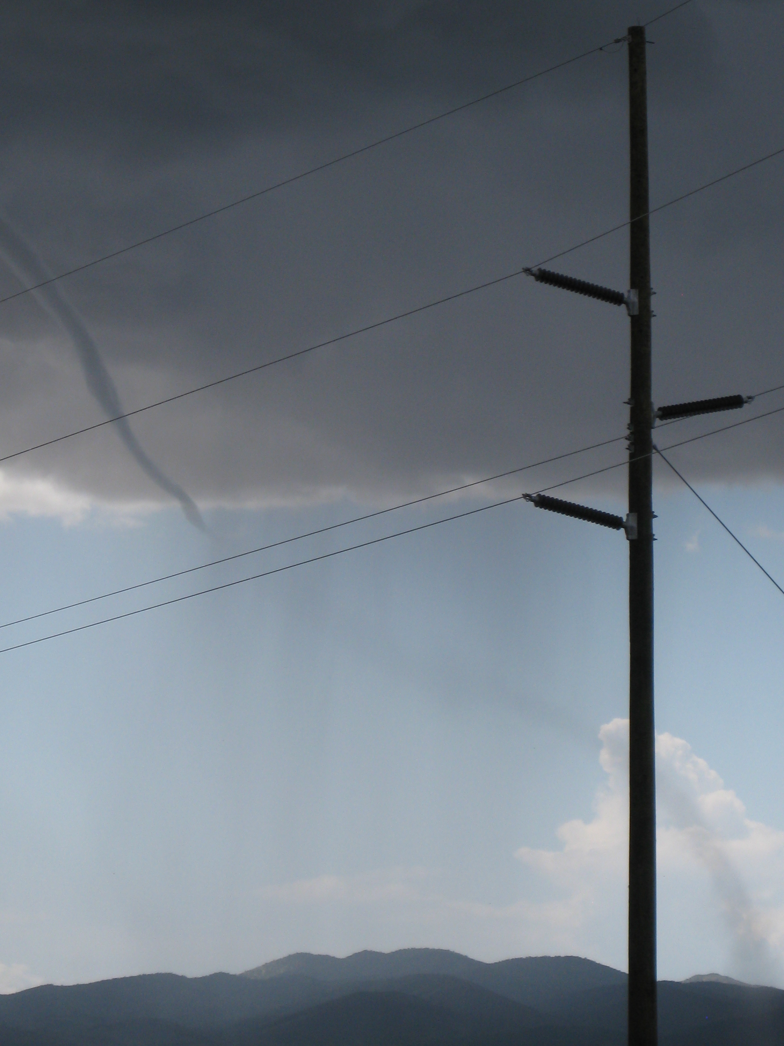
Tornado, 5 miles west of Milford, Beaver County
May 24, 2009 1130 MST, 38 39'N, 113 10'W
A tornado (EF0) touched down briefly over open country. No damage was reported.
Tornado, Vernal, Uintah County
Aug 6 , 2009 1520 MST, 40 45'N, 109 54'W
A tornado (EF0) touched down briefly in the north portions of Vernal. Significant tree damage was reported.
 
Tornado, 23 miles WSW of Canyonlands National Park, Wayne County
Oct 6, 2010 1200 MST, 38 28'N, 110 28'W
A tornado estimated as EF0 touched down over open country near Twin Corral Flat. The tornado snapped or uprooted 25-30 juniper trees.
Safety Rules
Prepare a Home Tornado Plan:
Pick a place where family members could
gather if a tornado is headed your way. It could be
your
basement or, if there is no basement, a center hallway,
bathroom, or closet on the lowest floor.
Keep this place uncluttered.
If you are in a high-rise building, you may not have
enough time to go to the lowest floor. Pick a place
in a hallways in the center of the building free of
windows.
Conduct periodic tornado drills, so everyone remembers
what to do when a tornado is approaching.
Assemble a Disaster Supplies Kit containing:
First aid kit and essential medications.
Battery-powered radio, flashlight, and extra batteries.
Canned food and a can opener.
Bottled water.
Sturdy shoes and work gloves.
Written instructions on how to turn off your home's
utilities.
.
Stay Tuned for Storm Warnings
Listen to your local radio and television stations
for updated storm information.
Tornado Watches and Warnings are issued by county. Know
what a Tornado Watch and Warning
means:
A Tornado Watch means a tornado is possible in your
area.
A Tornado Warning means a tornado has been sighted and
may be headed for your area. Go
to safety immediately.
When a Tornado Watch is Issued...
Listen to local radio and television stations for
further updates.
Be alert to changing weather conditions.
Blowing debris or the sound of an approaching tornado
may alert you. Many people say a tornado
sounds like a freight train.
When a Tornado Warning is Issued...
If you are inside, go to the safe place you picked
to protect yourself from glass and other flying objects.
(Remember: it could be your basement or, if there is
no basement, a center hallway, bathroom, or closet on
the lowest floor.) The tornado may be approaching your
area. If you are outside, hurry to the basement of a
nearby sturdy building or lie flat in a ditch or low-lying
area.
If you are in a car or mobile home, get out immediately
and head for safety (as above).
After the Tornado Passes...
Watch out for fallen power lines and stay out of
the damaged area.
Listen to the radio or television for information and
instructions.
Use a flashlight to carefully inspect your home for
damage.
References
Alder, William J., "Monthly Climatological Summaries
of Utah: January 1980–to the Present." National
Weather Service Forecast Office, Salt Lake City, Utah.
Brough, R. Clayton, Dale L. Jones, and Dale J. Stevens,
Utah's Comprehensive Weather
Almanac. Publishers Press, Salt Lake City, Utah. 1987.
517 pages.
Butler, Elmer and Ray E. Marsell, "Cloudburst Floods
in Utah: 1939–1969."
Cooperative-Investigations, Report Number 11, U.S. Geological
Survey, 1972.
Eubank, Mark E. and R. Clayton Brough, Utah Weather.
WeatherBank Inc., Salt Lake
City, Utah. 1979. 284 pages.
Griffin, Rodney D., "Whirlwinds or Dust Devils," Utah's
Weather and Climate.
Publishers Press, Salt Lake City, Utah. 1996. Pages
23-24.
James, David R., "A Climatological and Geographical
Study of Tornadoes and
Waterspouts in Utah." Masters Thesis, Department of
Geography, Brigham Young University,
Provo, Utah. August 1987.
Monthly "Storm Report" from January 1980 through June
1993. National Oceanic and
Atmospheric Administration, National Weather Service,
U.S. Department of Commerce.
Pope, Dan and Clayton Brough, Utah's Weather and Climate.
Publishers Press, Salt
Lake City, Utah. 1996. 245 pages.
Simpson, Joanne, G. Roff, B.R. Morton, K. Labas, G.
Dietachmayer, M. McCumber, and
R. Penc, "A Great Salt Lake Waterspout," Monthly Weather
Review, Volume 119, December
1991, pp. 2741–2770. American Meteorological Society,
Boston, MA.
"Tornado Breakdown by Counties: 1950–1992" for
Utah. Computer printout published
by the National Severe Storms Forecast Center, Kansas
City, MO.
Woolley, Ralf R., "Cloudburst Floods in Utah: 1850–1938."
Water Supply Paper 994,
U.S. Department of the Interior. 1946.
Utah Tornado
& Waterspout Photos
Utah's Most Dangerous
Weather!
Updated October 10th, 2010
|


