


| Also in this section |
| Air
Resources Geology Vegetation Water Wildlife Nature Home |
Yosemite National Park experiences a Mediterranean climate with typically long, hot summers and mild winters. Precipitation amounts vary from 36 inches (915 mm) at 4,000 feet (1200 m) elevation to 50 inches (1200 mm) at 8,600 feet (2600 m).
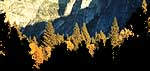
Yosemite has a variety of surface water features, some of which are a major attraction for park visitors. Some of the tallest waterfalls in the world are found in Yosemite Valley, including Yosemite Falls (with a total drop of 2,425 feet) and Ribbon Fall (1,612 feet). The Tuolumne and Merced River systems originate along the crest of the Sierra Nevada in the park and have carved river canyons 3,000 to 4,000 feet deep. The Tuolumne River drains the entire northern portion of the park, an area of approximately 680 square miles. The Merced River begins in the park’s southern peaks, primarily the Cathedral and Clark Ranges, and drains an area of approximately 511 square miles. Hydrologic processes, including glaciation, flooding, and fluvial geomorphic response, have been fundamental in creating landforms in the park.
 |
|
|
Yosemite Falls far is one of many waterfalls cascading into the Yosemite Valley. NPS Photo.
|
Water quality throughout Yosemite National Park is considered to be good and is generally above state and federal standards. An inventory of water quality performed by the National Park Service indicated pristine conditions in many parts of the park, with some water quality degradation in areas of high visitor use. The surface water quality of most park waters is considered by the State of California to be beneficial for wildlife habitat, freshwater habitat, and for canoeing, rafting, and other recreation, as indicated in the 1998 Central Valley Regional Water Quality Control Board’s Water Quality Control Plan.
Yosemite National Park has had 11 winter floods since 1916 that have caused substantial damage to property. All of these floods took place between November 1 and January 30. The largest floods occurred in 1937, 1950, 1955, and 1997 and were in the range of 22,000 to 25,000 cubic feet per second, as measured at the Pohono Bridge gauging station in Yosemite Valley.
Wetlands are areas that are saturated with surface water or near-surface groundwater for much of the year. They usually have no clearly defined ecological boundaries, but are a gradient between deepwater habitats, such as lakes and rivers, and upland terrestrial ecosystems, such as conifer forests.
Yosemite National Park Home Page
http://www.nps.gov /archive/yose/nature/water.htm
Last modified Wednesday, 22-Dec-2004 10:15:08 Eastern Standard Time
Yosemite National Park Web Manager