


above from left, amphora from Yangshao in China, 4500bc, pre-Columbian amphora found in museum in Oruro, Bolivia, (both made by hand without the potter's wheel); amphora "roman period", Mediterranean, amphora from Peru 1,000 to 1300AD, amphora from Canaan.
Persepolis was the ceremonial capital of the Persian empire and dates to 515BC,
deciphering Fuente Magna by Dr Clyde Winters
From Atlantis to the Sea An Adventure A journey to rival the adventures of Sinbad, from the sacred islands of the
Sun & Moon, Lake Titicaca, Peru, via inland waterways, mountain crossing and
sea voyage to the re-constructed court of King Solomon, Israel. History presents us with evidence of many now lost cities and civilisations,
many of which were thought to be legendary but have now been discovered such as
Nineveh with its marvellous library, Ur, foremost city of the Chaldees, Troy
with its multiple layers of city upon city and the treasure of Priam’s gold,
Knossos, capital of a maritime empire and whose palace displayed frescoes of
fashionable women in costumes that would not be out of place in modern Paris.
Two other cities of equal or even greater fame still await discovery. Atlantis,
the city whose walls and palaces were plated in sheets of gold, silver and gold
alloy and which Plato tells us sank into the sea in a single day of earthquakes
and rain. Tarshish, the city from which came the great treasure fleet every
three years bringing gold and silver which King Solomon used to plate the walls
of the Temple of Jerusalem. Modern technology allows us to forecast precisely the location of the former
of these two lost cities since Plato tells that it lay in the centre of a great
continent opposite the Pillars of Hercules (Straits of Gibraltar); it lay midway
along its longest side, the site was high above the level of the sea and took
the form of a rectangular plain enclosed by mountains which contained the metals
gold, silver, copper and tin. The plain itself was perfectly level and a vast
irrigation canal 600ft wide was said to run around its perimeter, the plain was
criss-crossed by smaller canals which also served for transportation purposes.
The city sank into the sea in a time of earthquakes and floods caused by a
single day of torrential rain. Satellite mapping shows that this description applies perfectly well to the
rectangular -shaped level Altiplano next to Lake Poopo, Bolivia so we may safely
say that it was not the continent of Atlantis which sank into the sea as
Plato himself thought, but only the island city of Atlantis which sank
beneath the inland sea of Lake Poopo. Indeed although we know the whole
continent by the European name of South America, this is not the true,
pre-Columbian name of the country. It was formerly called by the Inca ‘Land of
the Four Quarters’, one quarter of their empire being called ‘Antisuyo’, home of
the Antis indians all along the eastern slopes of the Andes. In the native
tongue, ‘Atl’ means ‘water’ and ‘Antis’ means ‘copper’ - Antis being, according
to Prescott, the correct name for the mis-pronounced ‘Andes’ mountains.
The Altiplano is a site which contains many volcanic islands of a similar size
to the one on which the city of Atlantis was founded and is still subject to
earthquakes and floods such as those which Plato said brought an end to the
city. The unique and precious metals such as gold, silver, copper and tin can
all be obtained from mines which exist nearby in the mountains bordering Lake
Poopo. Knowing the location of the lost city of Atlantis give an insight into the
location of the second previously mentioned city, Tarshish. Ezekiel tells us
that in the days of King Solomon "once in every three years came the navy of
Tharshish bringing gold, and silver, ivory and apes, and peacocks". It is
usually but forward that Tharshish existed somewhere near the mouth of the
Guadalquivir River near Cadiz, Spain. But a fleet from here would not take three
years to reach King Solomon, neither would a fleet from Spain be likely to
include ivory and certainly improbable that it would contain peacocks for these
magnificent birds originated in Ceylon. It should be noted that the Temple of King Solomon was designed and built for
him by the Phoenician King Hiram of Tyre who provided mariners - the men from
Gebel- a port on the gulf of Aqaba and it was here that the metals were landed
and the ornaments for the Temple cast in clay moulds in the ground. The temple
was also similar to the temple of Poseidon in Atlantis since it was similarly
hung in sheets of gold - according to Kings 10/22 in the days of Solomon,
because of the imports, gold "was so plentiful as to be accounted as nothing".
But where were King Solomon’s mines? The imported metals also included lead and tin. Tin was a sought after metal
since it could be alloyed with copper to produce bronze, gradually superseded by
iron, also on the list of imported metals. But tin is an unusual metal in that
it occurs in very few places in the world, small deposits in Cornwall and NW
Spain, main deposits in Malaysia and most of all in Bolivia where there still
exists a mountain of solid tin. And along with tin, is usually found silver. One of the Greek histories tells us that the city of Tharshish lay on an
island in the delta of a river. When the river reached its mouth it divided into
two and between the arms thus formed there was an island on which was
established the city. The river was said to carry in its stream gold, bronze,
silver and tin and if one followed the river upstream to its source, one came to
a mountain of solid silver.
Such a mountain does not exist in the region of the Guadalquivir River,
Spain and no ancient city has been found at the mouth of this river. But from
the delta of the Rio Parana, Argentina, where it discharges into the Rio de la
Plata which means ‘river of silver’, if one follows this river upstream
one comes to a mountain not far from Lake Poopo, Bolivia. This is Mt Potosi,
the mountain of solid silver which was exploited by the Spanish conquistadors
and became a fountain of wealth for the Spanish Empire. The silver was at first
shipped along the River Pilcamayo which was formerly called "the river of
silver" but because of Spanish tax laws and difficulty of the route with hostile indians,
the silver was ordered to be shipped to
Spain via Lima and Panama in order to develop these two cities; the original
route became forgotten but the name remained in the Rio de la Plata where the
river discharges near Buenos Aires. The city of Tharshish would probably have been at the highest point upstream where seagoing ships could reach,
thus the entrance to the pilcomay made an ideal location for a transhipment city.
for the overseas shipment of metals. When contact
was lost with the great continent, the city itself became lost in the silting mud
but in antiquity the site was remembered as a place where silver was so
plentiful that even the ships anchors were cast in silver.
Who surveyed the world in antiquity? When the Phoenicians sailed westwards to found
the new capital and centre of their great maritime and commercial empire, they
chose a site at Tunis, North Africa. This site is exactly 180° West of the continental land mass commencing at East Cape,
Siberia, placing their capital in the geographic centre of the world’s land
masses, no small achievement and impossible to dismiss as a coincidence. But
then did the Phoenicians inherit the maritime wisdom of Atlantis via the
mysterious Sea Peoples who attacked Egypt in the time of Ramesses III, gaining
thus the sea routes which enabled Hiram of Tyre to provide Solomon with the
metals to plate the Temple.
In the gold museum at La Paz, Bolivia, statues with
inlaid gold tears are said to be weeping for the lost city of Atlantis. A few km
to the north of La Paz, and some 20km from Lake Titicaca lies the mysterious
city of Tiahuanaco, the oldest known city in the Americas and at one time a sea
port on the edge of Lake Titicaca (known locally as Titicaca Sea and
which has now receded.) On Lake Titicaca exists the islands of the Sun and the
Moon, said to be the birthplace of the god Viracocha who emerged from these
islands after the flood and created the people who repopulated the country. The
islands are also the legendary birthplace of the Incas who founded an empire
stretching thousands of miles across the Andes. The Inca were people of Quecha
origin, children of the sun whereas the other great Altiplano race, the Aymara,
were children of the moon. And the moon may have been the ancient timepiece used
for the calculation of longitude, the Inca themselves using a sidereal lunar
calendar based on a period of 20 Inca years when all the lunar phases repeated
themselves. In the year 1540, a vast expedition of 350 Spaniards and 4,000 indians under
the leadership of Gonzalo Pizarro, brother of Franciso Pizarro set out from
Quito, Ecuador to explore the interior of South America. Reaching the waters of
the River Napo, Gonzalo ordered the construction of a brigantine and being short
of supplies, sent a body of 50 men under Francisco de Orellana ahead to secure
provisions. The current swiftly carried the boat off down river never to rejoin
the main group which after an absence of two years of extreme hardship found its
way back to Quito. Orellana’s voyage became known as the Great Descent - the
first to navigate the length of the Amazon and it was Orellana who gave it its
name, Rio de las Amazonas - River of the Amazons, on account of the fierce
fighting women they encountered along its banks. Orellano on his return to Spain
via Cuba also brought with him tales of the golden city of El Dorado thought to
lie in the interior. The route to the sea via the Amazon is one option which may have existed
since ancient times and is a route which has certainly been retraced in modern
times. A lesser known route is the route from the Altiplano via the rivers Pilcamayo and the Parana
to the estuary at Rio de la Plata and thence by sea under the Cape of Good Hope
following the tradewinds and up the Red Sea to the Gulf of Aqaba. The adventure begins at the island of the Sun, traditional birthplace of the Inca and the original Inca landing place and stone stairway still exists today.
Using traditional reed boats
from Lake Titicaca, the expedition sets out to navigate the waters of the River
Desaguadero, 150 miles south to Lake UruUru and thence to Lake Poopo. The water
levels were formerly much higher than today facilitating the use of numerous now
abandoned irrigation canals which exist all over the region of Lake
Titicaca/Poopo. The name of Lake UruUru should not go unnoticed since the Urus
were the original lakeside dwellers of the Altiplano and Ur was also the ancient
capital of the Chaldees in Mesopotamia, in the Sumerian language, ‘Urutu’
meaning ‘river of copper’ - the first people of Mesopotamia also dwelt amongst
the marshes and used reed boats similar to those of Titicaca. Along the route of the Desaguadero River lie many ancient archaeological
sites, gold and copper mines and in the museum at Oruro
exists a Mediterranean style amphora which dates from around 1200BC - suggesting
a trans-Atlantic contact. On arrival at Lake Poopo, the expedition continues to
the volcanic island of Pampa Aullagas, the site of ancient Atlantis which exists
at the southern end of the lake about three miles from the lakes edge - but when
the lake floods, it becomes an island. At other times the lake dries up altogether,
so these days the route is no longer as feasible by boat as it was in the days of
the Urus who lived along the edges of the lakes and waterways and on floating islands
on the lakes themselves.
Pampa Aullagas exists in the correct location for the missing city of Atlantis and shows how
the city was built on the edge of the level plain and next to the sea, as Plato said, "50 stades from the sea."
From Pampa Aullagas, it is but a short distance to the upper waters of the Pilcomayo River,
here called "Rio de Aquas Calientes" (River of hot waters)
and
the route now proceeds down the course of the Pilcomayo River,
past the Silver Mountain and down to the town of Villamontes which is where the heights
of the Andes are left behind and the River Pilcomayo formerly took its course down to the
island of Tarshish at the entrance to the river opposite Asuncion.
The Pilcamayo River, the original ‘River of Silver" was the route to the Altiplano
and carried in its stream the gold, silver, copper and bronze for which the city of Tarshish was famous.
From Asuncion, the river is broad and navigable by large vessels and one can proceed
by ship or by land as far as Buenos Aires in the delta of the Parana River.
At Buenos Aires one has reached the sea, the Atlantic Ocean and from here the route
taken by the first ancient reed ships was probably
via the Indian Ocean
and Red Sea to the Persian Gulf, giving access to the first settlements on the Indus Valley, Mesopotamia, ancient Egypt,
and via the Gulf of Aqaba through the historic Valley of Jordan to the state of Israel,
thus symbolising the voyage of the fleets of Tarshish which brought peacocks, ivories and precious
metals to the court of King Solomon every three years according to the bible account.
Today the Pilcomayo is dried up and no longer
navigable but the route from Puerto Suarez in Bolivia on the rio Parana to Buenos Aires
and also the river route along the rio Grande via the Amazon to the Atlantic have both
been followed in reed boats by Col John Blashford Snell in his
Kota Mama expeditions I should mention that although many people seem to have the idea that the canals on the Altiplano
were connected with the sea, they were in reality connected with the inland sea, extending from Lake Titicaca
in the north, to Lake Poopo in the south,a considerable distance and thus, the boats which brought merchandise from
abroad could equally well be considered to be bringing merchadise from within the vast continent itself.
The river routes which led off the high altiplano to the lower levels were routes that could be followed in
the days before modern roads with porters transporting merchandise and canoes, as can be seen in the sixteenth century illustration below.
Jim Allen,
author: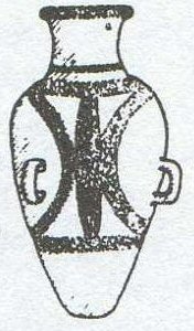


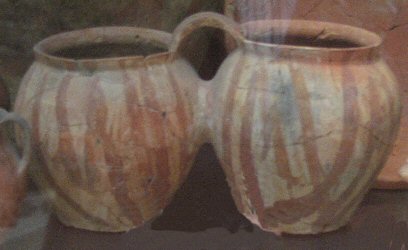
above left, pottery from Teotihuacan, Mexico, centre, pottery from Canaan/Edomite, right from Orinoca near Pampa Aullagas.


above left, jug found in museum in Oruro, Bolivia, centre, eastern Mediterranean jug, right,
jug from Thera.


above left, amphora from Levant, British Museum. Right, amphora in museum, Oruro, Bolivia.


above left, cypriot-Phoenician, centre, Cypriot 750bc, right, Israel 1200bc.


above left, Iran, British Museum. Right, Inca, Peru.


above from left, jug, Oruro, Bolivia, Holy Land 1500-1000bc, pre-Columbian Inca, right, Holy Land 1500-1000bc.


above left, Chanchay, Peru 1450-1100bc, right, Holy Land 1500-1000bc


above left, jug, Crete, right, jug Oruro


above left, Cypro-Phoenicians, middle, pre-Columbian Peru, right Holy Land 1500 to 1000bc


above left, storage jar from Egypt circa 3,000BC., right, pre-Columbian storage jar in museum in Tarija, Bolivia.


above left, pre-Columbian earthenware vessel. Right, vessel from Majiay, China.


above from left, pottery from Longshan in China, pre-Columbian Narino culture, pre-columban Tiwanaku, Ubaid Iraq.


above from left, duck figures, Peru, Etruscan, Lambayeque (Peru), right, Etruscan.


above left, Lambayeque, Peru, centre, Cyprus 2500 to 2100bc, right, Chimu, copper/gold.


Above, left, Mycenean stirrup jar, centre, Nicaraguan stirrup jar,


Above, left, jar from Crillon museum, Huatajata, Bolivia. Centre, Uganda. Right, Egyptian, attributed as copy of Mycenean stirrup jar .


Above left, Peru, 250-800AD, next, Cyprus imported 1650-1050BC,
right, llama head Machu Picchu


Left, bridge and spout ceramic, Peru. Centre, "base and ring ware with bull's head" Cyprus. Right,
"black on red ware with bull's head" Cyprus.

Above, explanation of how pottery made in Cyprus may have been copied or
inspired by pottery imported from Phoenicia.

Above, typical jug made in Cyprus with "Atlantis symbol" of concentric circles.


above left, Kabyle, Algeria, 19th century copy of traditional double vessel said to have Phoenician influence.
centre and right, typical pre-columbian "whistling" double bottles, Peru.


Left, pre Columbian Tairona double jug. Right,
double jug from Cyprus.


Above left, double pots, Cyprus. Right, double pots, Chirique, pre-Columbian.
Above, double pots, Levant.


above left, double bottle, pre-Columbian Peru 4th to 8th century, centre, Naqada, Egypt, right, Yangshao, China, 4500 to 3,000bc.

above, double jug, Cyprus 1600 to 1340bc, British Museum.

above Philistine pottery from Ashdod, note on the pot behind, the "Andean" cross surrounded by concentric rings.


above left, cross found on fragment of Philistine pottery, right, cross symbol at Tiwanaku, Bolivia.


Above, left, tee clamp recess on stone at Tiwanaku, above centre, tee clamps from ancient Egypt,
right tee clamp recess on stone at Acropolis, Athens. The famous
building called the Parthenon which sits on top of the Acropolis in Athens was built by
Pericles following on from the destruction of an earlier Parthenon by the invading Persians
in 460BC.


Above, left, stone conduit at Tiwanaku,
right, stone conduit at Acropolis, Athens.


Above, left, gateway at Tiwanaku, above centre for comparison, gateway at
Persepolis, Iran. Above, right, detail from gateway at Tiwanaku.
making
it roughly contemporary with the earliest stages of the Kalasasaya at Tiwanaku.


Above, left, gateway at Tiwanaku carved from a single block of stone, right sketch of windows and doors at Persepolis


Above, left, casing stone of the Great Pyramid in Egypt,
above, right, stone found on the Atlantis mountain, Pampa Aullagas, Bolivia.


above left, spindle whorls Iran, 5000 to 1500BC, right, spindle whorls Teotihuacan,
Mexico 200-800AD


above left, axe in museum in Cochabamba, Bolivia, right, axe from Cyprus 1100BC.
 :
:
 :
:

above left, priest with "bishop's" hat in the Crespi collection,
centre, priest with "bishop's hat in Tiwanaku, right, priest with "bishop's" hat at entrance to Hatussa, Turkey.
.


above left, headdress of the Sea peoples, centre, Amazonian headdresses, right, Tula mexico and Tiwanaku, Bolivia.


above left, sea peoples with high headdresses, right, South American Indian headdress.


above left, Elamite headgear, Iran, 1000bc, right, Persian headgear.


Above, Assyrian god with eagle head mask and feathered headdress on the back,
native American costume with circular headdress on back,
American eagle dance illustration showing circular headdress on the back,
Aztec eagle mask headdress with feathers,


Above, left, Assyrian god with eagle mask, right
Assyrian style sculpture from the Crespi collection, Ecuador.


Above, left, Assyrian sculpture with feathered eagle mask from the palace of Nimrud, 883 to 859BC,
right
traditional Mexican eagle feathered mask headdress.

Above, left, Assyrian sculpture with eagle mask and feathered "wings" from the palace of Nimrud, 883 to 859BC,
right, Aztec with eagle mask, feathered costume and feathered "wings".


Above, left, Mexican god carrying unidentified bucket or basket,
centre,
Assyrian god carring unidentified bucket or basket, note, the upper "wings" are part of a circular feathered
decoration as seen in the native American photo, right.


Above, left, Sumerian chief of the gods, Anu, the upper wings are similar to the native American
feather decoration seen from behind, centre. The lower "wings" are similar
to the "tails" of a typical native American headdress often seen in side elevation, right.

It has been thought by some people that what the deity is holding is a cob of maize, brought to Mesopotamia but which subsequently
failed to cultivate there. Note the feathered headdress.

Close up, Maize? Fir cone? or male spathe from date palm?


Above, left, from the "tree of life", Assyrian corn? centre, yellow corn, right, male cone.
Some think the object is a fir cone which was dipped in the bucket of water and used to sprinkle water on the tree to "purify" it.
Others think it represents corn or maize which was introduced by visiting beings to Mesopotamia but which failed to cultivate there. Others think it
was the spathe of the male date palm
used to pollinate and cultivate the date palm trees.

Above, left, modern version of traditional eagle dance, right, similar wings
in ancient Egyptian sculpture.

Above, left, native American Eagle Dance costume, right, similar wings
in ancient Egyptian sculpture.

Above, left, imperial eagle, right, Assyrian symbol with similar wings
also with gods wearing winged costume and fish costume.


Above, 1st and 2nd, Chaldean gods wearing fish costume, Assyrian god with fish costume, right - native Americans such as Aztecs
dressed in animal and bird costumes.

Above, left, Chaldean god in the shape of a merman. Right, black ceramic sculpture of mermaid from Tiwanaku.
The "legend of Copacabana" in Bolivia tells of a mermaid from Lake Titicaca who was worshipped as a divinity before
the site was adopted for the construction of the now famous church there.
Above, black ceramic from Tiwanaku depicting sphinx-like animal with human head and feathered headdress.


Above, left, Egyptian headgear of Ptolemy, right, black ceramics with Egyptian style headgear from Tiwanaku.

Above, artefact from the Crespi collection, Ecuador showing stylised Egyptian representations.


above left, Anasazi petroglyph, right, cup and ring mark, Northumberland, England.
Note how both sets of rings have a channel from the centre to the outermost ring.
Also the figure on the left is wearing a feathered headdress and circular feathered decoration on his back.


above left, headdress of Mayan nobleman, right, headdress of Cretan nobleman.


Above, left, zigurrat of the Sumerians, right zigurrat at Uxmal, Mexico.


Above, left, statue from Tiwanaku, note the style showing two left hands, right drawing of Seti I of Egypt
note the two left hands.


Above, left, Egyptian sculpture with two left hands, right meso American sculpture with two left hands.


above left, Aztec wheeled toy, centre, Sumerian wheeled toy 5500BC, right, ancient Ukrainian wheeled toy.


above left, stone door from Tiwanaku - there is said to be an underground city and tunnels beneath Tiwanaku,
right, circular stone door from underground city of Derinkuyu in Turkey


Above left, another stone door from Tiwanaku - note how the stone is not perfectly round, but has
straight edges on the right hand side and base, therefore it was not a wheel, but a door.
Centre, circular stone door from underground city of Derinkuyu in Turkey, right stone door from underground site in Turkey with straight edge on right hand side and also on base.....

Above, another stone door from underground city in Turkey.

Above, Eduardo Montańo discovers three of these ancient round stones
covered in fossilised "coral" at prehistoric city of Pumiri, Bolivia, April 2014.

Above, map illustrating underground city in Turkey
where round stone doors were used to block tunnel entrances.


The discovery of the Fuente Magna, a large stone dish covered in proto-cuneiform writing
from the shores of LAKE TITICACA
offers two possibilities. One, that it was brought to the Andes
by the proto-Sumerians - but it has Andean motifs on the outside
so was not brought from somewhere else, or two, that the Sumerians themselves
originated here or visited here.

the island in the entrace to the river of silver (Pilcomayo).
Follow the route of the river upstream and you come to the silver mountain of Potosi, beyond that the tin mines
in present day Bolivia, also mines of copper and gold. Note to the south of the island's location,
mountains of iron. (Mt. de Hierro).

“I am rich Potosí, the treasure of the world and the envy of kings.”


above, the name of the silver river still survives in the region of Bueno Aires
where in Spanish, it is called "Rio de la Plata".


From high levels such as the Altiplano, goods could be transported overland
following the
river routes
and carrying canoes where there were insufficient or unnavigable sections of water.

Above, location of the mines near Lake Poopo and the Atlantis site on the Altiplano.
All the metals mentioned by Plato are found in the region adjoining Lake Poopo.

Above, river routes through South America could be followed
to reach the silver, tin and gold mines of the Altiplano and Atlantis.

Above, river routes from the south-east side of the Altiplano.
The river Pilcomayo was a route which could be followed
to the Silver Mountain
at Potosi, and beyond to the tin, gold and copper mines near Lake Poopo.
Atlantis: the Andes Solution
The Atlantis Trail
Atlantis: Lost Kingdom of the Andes
Atlantis and the Persian Empire
webatlantis@hotmail.com

